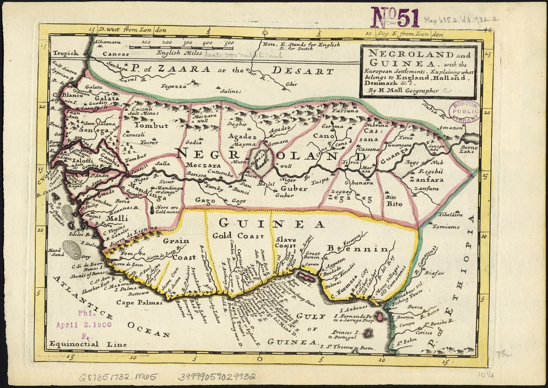
Negroland and Guinea : with the European settlements explaining what belongs to England, Holland, Denmark &c
Item Information
- Title:
- Negroland and Guinea : with the European settlements explaining what belongs to England, Holland, Denmark &c
- Creator:
- Moll, Herman, d. 1732
- Publisher:
- Bowles, John, 1701-1779
- Publisher:
- Bowles, Thomas, 1694-1773
- Name on Item:
-
by H. Moll ...
- Date:
-
[1732?]
- Format:
-
Maps/Atlases
- Location:
-
Boston Public Library
Norman B. Leventhal Map Center - Collection (local):
-
Norman B. Leventhal Map Center Collection
- Subjects:
-
Africa, West--Maps--Early works to 1800
- Places:
-
West Africa (area)
- Extent:
- 1 map : col. ; 21 x 28 cm.
- Terms of Use:
-
No known copyright restrictions.
No known restrictions on use.
- Publisher:
-
London :
Printed for Tho. Bowles and John Bowles
- Scale:
-
Scale [1:12,500,000].
- Language:
-
English
- Notes:
-
Imprint derived from the atlas in which the map was issued.
Shows boundaries, rivers and settlements.
Numbered 48.
Relief shown pictorially.
London meridian.
Appears in the author's Atlas minor. London: Printed for Tho. Bowles and John Bowles, 1732? or 1736?
West Africa, showing River Niger.
- Identifier:
-
06_01_007144
- Call #:
-
G8735 1732 .M65
- Barcode:
-
39999059029932