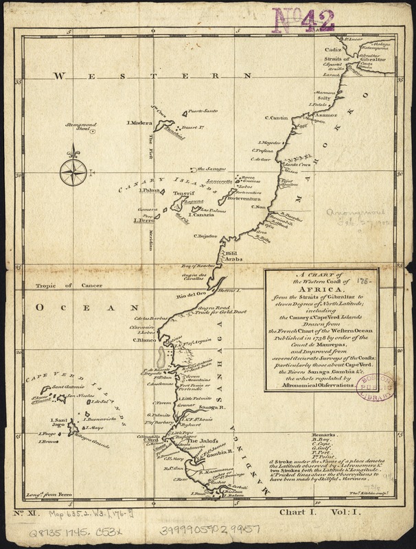
A chart of the western coast of Africa, from the Straits of Gibraltar to eleven degrees of north latitude : including the Canary & Cape Verd Islands
Item Information
- Title:
- A chart of the western coast of Africa, from the Straits of Gibraltar to eleven degrees of north latitude : including the Canary & Cape Verd Islands
- Name on Item:
-
drawn from the French chart of the Western Ocean published in 1738 by order of the Count de Maurepas, and improved from several accurate surveys of the coasts, particularly those about Cape Verd, the Rivers Sanaga, Gambia &c. the whole regulated by astronomic observations ; Thos. Kitchin Sculpt.
- Date:
-
[1745–1747]
- Format:
-
Maps/Atlases
- Location:
-
Boston Public Library
Norman B. Leventhal Map Center - Collection (local):
-
Norman B. Leventhal Map Center Collection
- Subjects:
-
Africa, West--Maps
- Places:
-
West Africa (area)
- Extent:
- 1 map ; 24 x 19 cm.
- Terms of Use:
-
No known copyright restrictions.
No known restrictions on use.
- Publisher:
-
London :
Printed for Thomas Astley, at the Rose in St. Paul's Church-Yard, London
- Scale:
-
Scale [ca. 1:13,000,000].
- Language:
-
English
- Notes:
-
Relief shown pictorially.
"Longd. from Ferro."
Chart I from: A new general collection of voyages and travels ... Vol. 1, no. XI.
- Notes (date):
-
This date is inferred.
- Identifier:
-
06_01_007146
- Call #:
-
G8735 1745 .C53x
- Barcode:
-
39999059029957