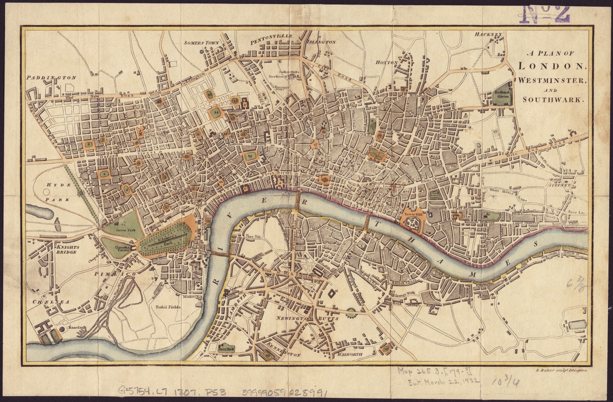
A plan of London, Westminster, and Southwark
Item Information
- Title:
- A plan of London, Westminster, and Southwark
- Publisher:
- Phillips, R. (Richard), Sir, 1767-1840
- Name on Item:
-
B. Baker sculpt.
- Date:
-
1807
- Format:
-
Maps/Atlases
- Location:
-
Boston Public Library
Norman B. Leventhal Map Center - Collection (local):
-
Norman B. Leventhal Map Center Collection
- Subjects:
-
London (England)--Maps
Westminster (London, England)--Maps
Southwark (London, England)--Maps
- Places:
-
EnglandLondonCity of Westminster
EnglandLondonSouthwark
- Extent:
- 1 map : col. ; 17 x 28 cm.
- Terms of Use:
-
No known copyright restrictions.
No known restrictions on use.
- Publisher:
-
[London] :
Published ... by Rich. Phillips ...
- Scale:
-
Scale [1:26,750].
- Language:
-
English
- Notes:
-
Shows river, streets, parks and squares; locations numbered as for reference, but lacks reference list.
London.
- Identifier:
-
06_01_006978
- Call #:
-
G5754.L7 1807 .P53
- Barcode:
-
39999059028991


