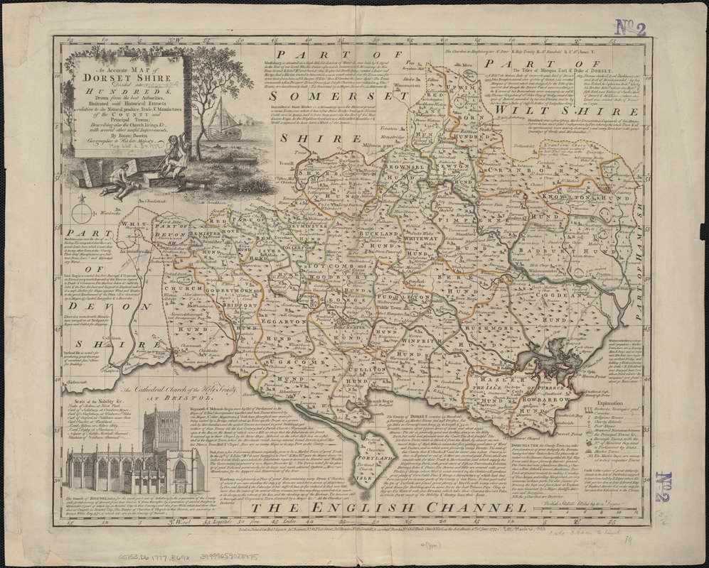
An accurate map of Dorset Shire divided into hundreds
Item Information
- Title:
- An accurate map of Dorset Shire divided into hundreds
- Creator:
- Bowen, Emanuel, d. 1767
- Name on Item:
-
drawn from the best authorities, illustrated with historical extracts relative to its natural produce, trade & manufacturers of the county and prinicpal towns; describing also the church livings &c. with several other useful improvements by Eman: Bowen.
- Date:
-
1777
- Format:
-
Maps/Atlases
- Location:
-
Boston Public Library
Norman B. Leventhal Map Center - Collection (local):
-
Norman B. Leventhal Map Center Collection
- Subjects:
-
Dorset (England)--Maps--Early works to 1800
- Places:
-
EnglandDorset (county)
- Extent:
- 1 map : outline col. ; 40 x 49 cm.
- Terms of Use:
-
No known copyright restrictions.
No known restrictions on use.
- Publisher:
-
London :
Printed for Robt. Sayer & Jno. Bennett ... Jno. Bowles ... Carington Bowles ...
- Scale:
-
Scale ca. 1:222,000.
- Language:
-
English
- Notes:
-
Relief shown pictorially.
Includes notes about towns and places of interest, Seats of the Nobility &c., the Titles of Marquis, Earl & Duke of Dorset, and ill. of the Cathedral Church of the Holy Trinity at Bristol.
- Identifier:
-
06_01_006975
- Call #:
-
G5753.D6 1777 .B69x
- Barcode:
-
39999059028975


