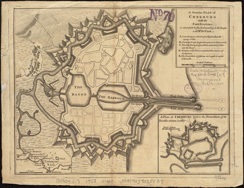
A genuine plan of Cherburg with the fortifications : as intended to be finished according to the design of Mr. De Caux
Item Information
- Title:
- A genuine plan of Cherburg with the fortifications : as intended to be finished according to the design of Mr. De Caux
- Date:
-
[1758]
- Format:
-
Maps/Atlases
- Location:
-
Boston Public Library
Norman B. Leventhal Map Center - Collection (local):
-
Norman B. Leventhal Map Center Collection
- Subjects:
-
Cherbourg (France)--Maps--Early works to 1800
- Places:
-
FranceCherbourg
- Extent:
- 1 map ; 19 x 25 cm.
- Terms of Use:
-
No known copyright restrictions.
No known restrictions on use.
- Publisher:
-
S.l :
s.n.
- Scale:
-
Scale not given.
- Language:
-
English
- Notes:
-
Relief shown by hachures.
Insets: A plan of Cherburg before the demolition of its fortifications in 1689, [Cherbourg Road].
Appears in Gentlemen's Magazine, vol. 28, August 1758, opp. p. 346.
- Notes (date):
-
This date is inferred.
- Identifier:
-
06_01_006824
- Call #:
-
G5834.C7 1758 .G46x
- Barcode:
-
39999059028439


