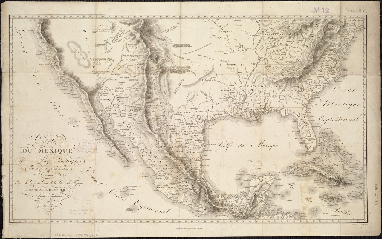
Carte du Mexique et des pays limitrophes situés au nord et à l'est : dressée d'après la grande carte de la Nouvelle Espagne de Mr. A. de Humboldt et d'autres matériaux
Item Information
- Title:
- Carte du Mexique et des pays limitrophes situés au nord et à l'est : dressée d'après la grande carte de la Nouvelle Espagne de Mr. A. de Humboldt et d'autres matériaux
- Description:
-
Baron Alexander von Humboldt was a German geographer who visited the region in 1803 and researched unpublished cartographic resources and documents in the Mexican archives. The resulting map provided Europeans and Americans with the most comprehensive printed geography of Mexico to date, recognizing the names and lands of Native Americans living on the country’s northern frontier (today’s southwestern United States).
- Creator:
- Poirson, J. B. (Jean Baptiste), 1760-1831
- Name on Item:
-
par J.B. Poirson ; gravé par Barriere ; l'́ecriture par L. Aubert.
- Date:
-
1811
- Format:
-
Maps/Atlases
- Location:
-
Boston Public Library
Norman B. Leventhal Map Center - Collection (local):
-
Norman B. Leventhal Map Center Collection
- Subjects:
-
North America--Maps
Mexico--Maps
- Places:
-
North America (area)
Mexico
- Extent:
- 1 map ; 41 x 71 cm.
- Terms of Use:
-
No known copyright restrictions.
No known restrictions on use.
- Publisher:
-
Paris :
chez F. Schoell
- Scale:
-
Scale [ca. 1:8,000,000].
- Language:
-
French
- Notes:
-
Relief shown by hachures.
- Notes (exhibitions):
-
Exhibited: "Crossing Boundaries: Art // Maps" organized by the Norman B. Leventhal Map & Education Center at the Boston Public Library, 2018-2019.
- Identifier:
-
06_01_006778
- Call #:
-
G4410 1811 .P65
- Barcode:
-
39999059028058