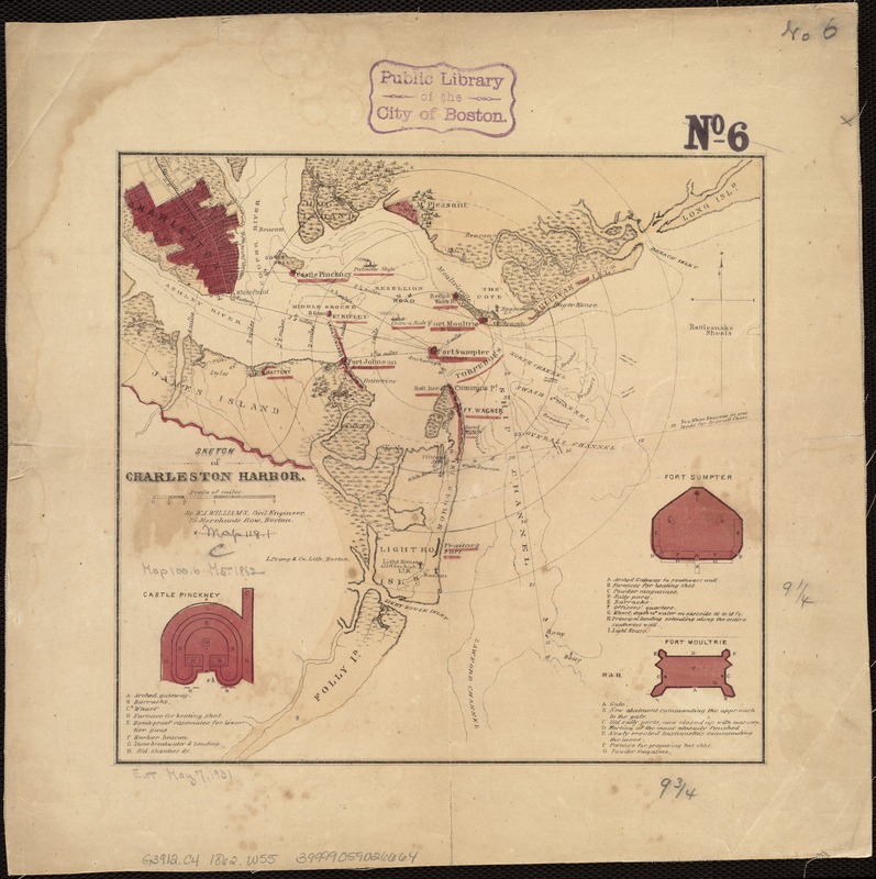
Sketch of Charleston Harbor
Item Information
- Title:
- Sketch of Charleston Harbor
- Creator:
- Williams, W. A., 19th cent
- Name on Item:
-
by W.A. Williams.
- Date:
-
[1860?–1869?]
- Format:
-
Maps/Atlases
- Location:
-
Boston Public Library
Norman B. Leventhal Map Center - Collection (local):
-
Norman B. Leventhal Map Center Collection
- Subjects:
-
Fortification--South Carolina--Charleston
Charleston Harbor (S.C.)--History--19th century--Maps
- Places:
-
Charleston (county)Charleston Harbor (bay)
Charleston (county)Charleston
- Extent:
- 1 map : col. ; 24 x 25 cm.
- Terms of Use:
-
No known copyright restrictions.
No known restrictions on use.
- Publisher:
-
Boston :
L. Prang & Co.
- Scale:
-
Scale ca. 1:70,000.
- Language:
-
English
- Notes:
-
Shows fortifications, street pattern of Charleston, vegetation, and a few soundings.
Insets: Castle Pinckney. 7 x 5 cm-Fort Sumpter [sic]. 7 x 6 cm-Fort Moultrie. 5 x 6 cm.
Description derived from published bibliography.
Variant showing the earthworks on James Island extending horizontally from the coast to the left neat line and includes additional sites and military information.
- Identifier:
-
06_01_006574
- Call #:
-
G3912.C4 1862 .W55
- Barcode:
-
39999059026664


