A map of the Yearly Meeting of Friends for New England : 1850
Item Information
- Title:
- A map of the Yearly Meeting of Friends for New England : 1850
- Description:
-
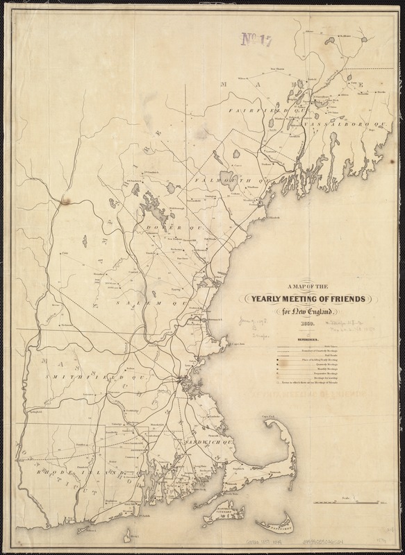
The anti-slavery movement had a long history and many voices. One of the earliest and most vocal was from the Quakers, first in Pennsylvania but also in New England and the Ohio River Valley. Although various New England denominations and societies were involved in the anti-slavery movement, this map showing Quaker meeting houses in New England not only underscores their rhetoric against slavery but also their involvement in assisting slaves to escape their bondage. By comparing this map with maps of the Underground Railroad, it is possible to see a strong correlation between the meeting houses and communities involved with the railroad.
- Creator:
- New England Yearly Meeting of Friends
- Engraver:
- Smith, George Girdler, 1795-1878
- Name on Item:
-
engraved by George Girdler Smith.
- Date:
-
1850
- Format:
-
Maps/Atlases
- Location:
-
Boston Public Library
Norman B. Leventhal Map Center - Collection (local):
-
Norman B. Leventhal Map Center Collection
- Subjects:
-
Society of Friends--New England
Railroads--New England--Maps
New England--Maps
- Places:
-
New England (area)
- Extent:
- 1 map ; 55 x 39 cm.
- Terms of Use:
-
No known copyright restrictions.
No known restrictions on use.
- Publisher:
-
[Newport, R.I.] :
Yearly Meeting
- Scale:
-
Scale 1:633,600.
- Language:
-
English
- Notes:
-
Includes table of references giving towns of meetings, boundaries of quarterly meetings, and railroads.
- Notes (exhibitions):
-
Exhibited: "Torn in Two: The 150th Anniversary of the Civil War" organized by the Norman B. Leventhal Map Center at the Boston Public Library, 2011.
- Identifier:
-
06_01_006556
- Call #:
-
G3720 1850 .N49
- Barcode:
-
39999059026524


