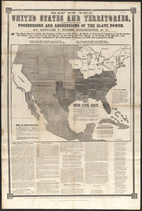
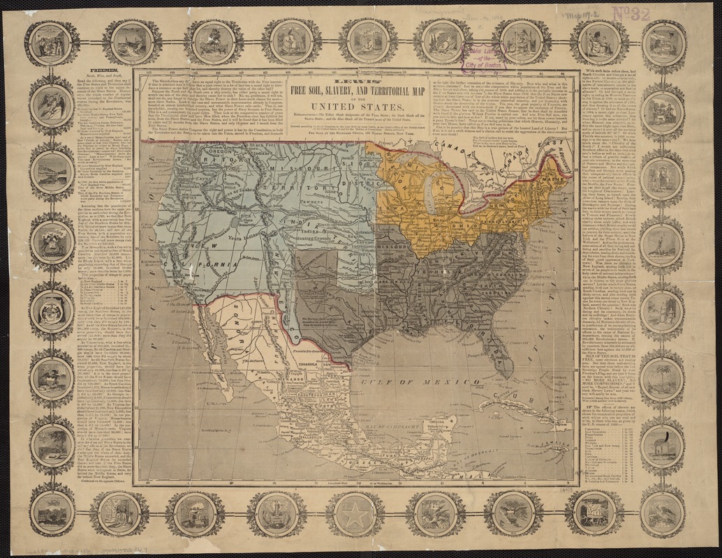
Lewis' free soil, slavery, and territorial map of the United States
Item Information
- Title:
- Lewis' free soil, slavery, and territorial map of the United States
- Description:
-
The war with Mexico changed the country’s contours. Following the war, a major concern was the status of these newly acquired lands – would they be slave or free? And what rights of citizenship would their residents receive? While state boundaries are not shown on the map itself, the presence of state symbols surround the map and underscore its message: Would the tenuous balance of slave and free states, which had held since the country’s founding, continue or be upset as states were carved out of this new territory?
- Creator:
- Lewis, John C., 1820-1883
- Date:
-
[1848]
- Format:
-
Maps/Atlases
- Location:
-
Boston Public Library
Norman B. Leventhal Map Center - Collection (local):
-
Norman B. Leventhal Map Center Collection
- Subjects:
-
Slavery--United States--Maps
United States--Maps
- Places:
-
- Extent:
- 1 map : col. ; 35 x 37 cm, on sheet 47 x 61 cm.
- Terms of Use:
-
No known copyright restrictions.
No known restrictions on use.
- Publisher:
-
New York :
John Lewis
- Scale:
-
Scale not given.
- Language:
-
English
- Notes:
-
Relief shown by hachures.
Includes text and decorative border with the seals of numerous states.
- Notes (date):
-
This date is inferred.
- Notes (exhibitions):
-
Exhibited: "America Votes: Mapping the Political Landscape" organized by the Norman B. Leventhal Map Center at the Boston Public Library, 2012.
- Identifier:
-
06_01_006529
- Call #:
-
G3701.E9 1848 .L49x
- Barcode:
-
39999059026367