Map of the battle ground of Greenbrier River
Item Information
- Title:
- Map of the battle ground of Greenbrier River
- Description:
-
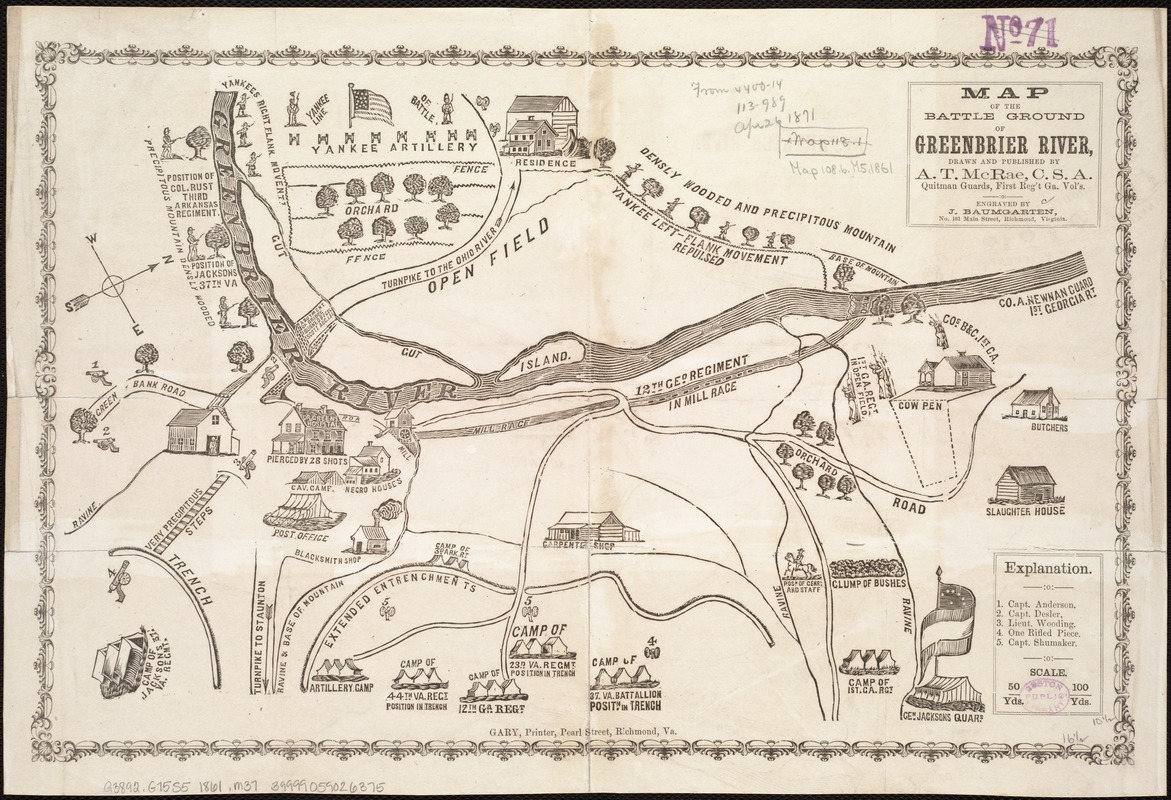
During the Civil War, daily newspapers used maps to inform their readers about the changing fortunes of an ensuing battle. Representing a Confederate viewpoint, this battle map features the strategic placement of troops, geographic topography, the position of enemy Yankee artillery, principal buildings, roads, and drainage.
- Creator:
- McRae, A. T.
- Name on Item:
-
drawn and published by A. T. McRae ; engraved by J. Baumgarten.
- Date:
-
[1861?]
- Format:
-
Maps/Atlases
- Location:
-
Boston Public Library
Norman B. Leventhal Map Center - Collection (local):
-
Norman B. Leventhal Map Center Collection
- Subjects:
-
Greenbrier River, Battle of, W. Va., 1861--Maps
Greenbrier River (W. Va.)--Maps
- Places:
-
Greenbrier
- Extent:
- 1 map ; 27 x 42 cm.
- Terms of Use:
-
No known copyright restrictions.
No known restrictions on use.
- Publisher:
-
Richmond, Va :
A.T. McRae
- Scale:
-
Scale ca. 1:11,200.
- Language:
-
English
- Notes:
-
Confederate imprint.
Gary, Printer, Pearl Street, Richmond, Va.
Sketch map showing Confederate camps and batteries, position of "Yankee artillery," "Gen. Jacksons quars.," "posn. of Genrl. and staff" during engagement, drawings of principal buildings, roads, and drainage.
Description derived from published bibliography.
- Notes (exhibitions):
-
Exhibited: "Crossing Boundaries: Art // Maps" organized by the Norman B. Leventhal Map & Education Center at the Boston Public Library, 2018-2019.
- Identifier:
-
06_01_006530
- Call #:
-
G3892.G75S5 1861 .M37
- Barcode:
-
39999059026375
- LCCN:
-
99446353


