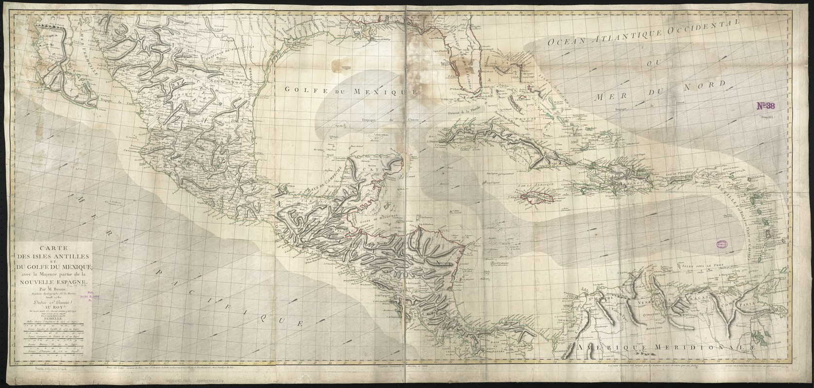
Carte des isles Antilles et du Golfe du Mexique : avec la majeure partie de la nouvelle Espagne
This map is also available in American Revolutionary Geographies Online (ARGO), a collections portal especially built for material relating to the American Revolutionary War Era. Visit ARGO to learn more about this item and explore the historical geography of North America in the late eighteenth century.
Item Information
- Title:
- Carte des isles Antilles et du Golfe du Mexique : avec la majeure partie de la nouvelle Espagne
- Creator:
- Bonne, Rigobert, 1727-1794
- Name on Item:
-
par M. Bonne ; revue et corrigée par l'auteur en May 1782.
- Date:
-
1782
- Format:
-
Maps/Atlases
- Location:
-
Boston Public Library
Norman B. Leventhal Map Center - Collection (local):
-
Norman B. Leventhal Map Center Collection
- Subjects:
-
West Indies--Maps--Early works to 1800
Caribbean Area--Maps--Early works to 1800
Mexico--Maps--Early works to 1800
- Places:
-
Mexico
West Indies
Caribbean Sea
- Extent:
- 1 map : col. ; 64 x 141 cm.
- Terms of Use:
-
No known copyright restrictions.
No known restrictions on use.
- Publisher:
-
A Paris :
Chez Lattre
- Scale:
-
Scale ca. 4,087,000.
- Language:
-
French
- Notes:
-
Relief shown by hachures.
Arrows indicate the direction of the winds.
Cataloging, conservation, and digitization made possible in part by The National Endowment for the Humanities: Exploring the human endeavor.
- Identifier:
-
06_01_006423
- Call #:
-
G4900 1782 .B66x
- Barcode:
-
39999059025526


