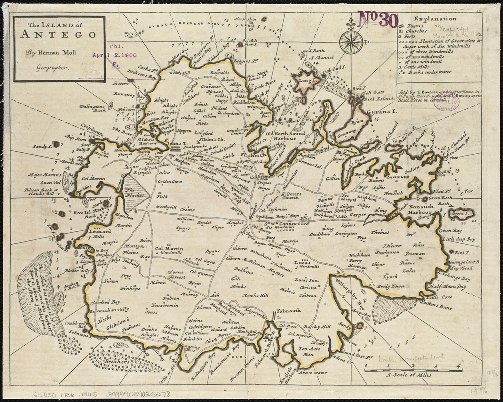
The island of Antego
Item Information
- Title:
- The island of Antego
- Creator:
- Moll, Herman, d. 1732
- Name on Item:
-
by Herman Moll.
- Date:
-
[1736]
- Format:
-
Maps/Atlases
- Location:
-
Boston Public Library
Norman B. Leventhal Map Center - Collection (local):
-
Norman B. Leventhal Map Center Collection
- Subjects:
-
Antigua--Maps--Early works to 1800
- Places:
-
Antigua and BarbudaAntigua (island)
- Extent:
- 1 map ; 29 x 37 cm.
- Terms of Use:
-
No known copyright restrictions.
No known restrictions on use.
- Publisher:
-
[London] :
Sold by T. Bowles and J. Bowles
- Scale:
-
Scale [ca. 1:86,000].
- Language:
-
English
- Notes:
-
Soundings in feet.
Shows churches, forts, plantations, windmills, cattle mills, submerged rocks, etc.
In upper right margin: 58.
Appears in the author's Atlas minor. London : Thomas Bowles and John Bowles, [1736].
Cataloging, conservation, and digitization made possible in part by The National Endowment for the Humanities: Exploring the human endeavor.
- Notes (date):
-
This date is inferred.
- Identifier:
-
06_01_006380
- Call #:
-
G5050 1736 .M65
- Barcode:
-
39999059025278


