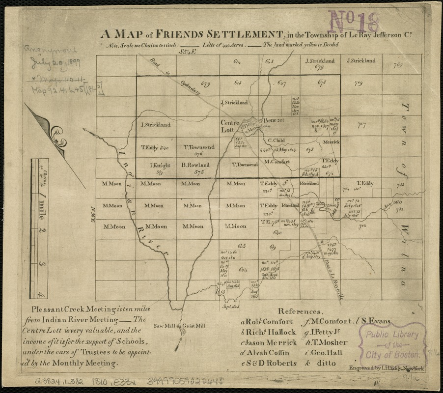
A map of Friends settlement, in the township of Le Ray Jefferson Co
Item Information
- Title:
- A map of Friends settlement, in the township of Le Ray Jefferson Co
- Creator:
- Eddy, John H. (John Hartshorne), 1783-1817
- Name on Item:
-
engraved by I.H. Eddy.
- Date:
-
[1810?–1819?]
- Format:
-
Maps/Atlases
- Location:
-
Boston Public Library
Norman B. Leventhal Map Center - Collection (local):
-
Norman B. Leventhal Map Center Collection
- Subjects:
-
Landowners--Pennsylvania--Le Raysville--Maps
Le Raysville (Pa.)--Maps
- Places:
-
Bradford (county)LeRaysville
- Extent:
- 1 map ; 21 x 24 cm.
- Terms of Use:
-
No known copyright restrictions.
No known restrictions on use.
- Publisher:
-
S.l :
s.n.
- Scale:
-
Scale ca. 1:79,200.
- Language:
-
English
- Notes:
-
Oriented with north toward the upper left.
Shows lots and owners.
Includes references and description of the settlement.
- Identifier:
-
06_01_006308
- Call #:
-
G3824.L382 1810 .E33x
- Barcode:
-
39999059022648


