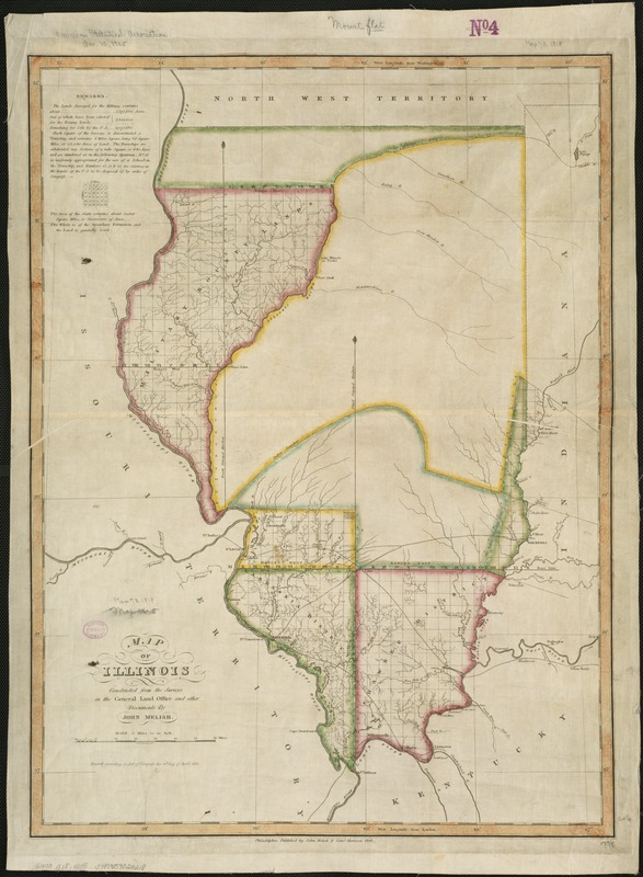
Map of Illinois
Item Information
- Title:
- Map of Illinois
- Creator:
- Melish, John, 1771-1822
- Name on Item:
-
constructed from the surveys in the General Land Office and other documents by John Melish.
- Date:
-
1818
- Format:
-
Maps/Atlases
- Location:
-
Boston Public Library
Norman B. Leventhal Map Center - Collection (local):
-
Norman B. Leventhal Map Center Collection
- Subjects:
-
Illinois--Maps
- Places:
-
Illinois
- Extent:
- 1 map : col. ; 64 x 46 cm.
- Terms of Use:
-
No known copyright restrictions.
No known restrictions on use.
- Publisher:
-
Philadelphia :
John Melish & Saml. Harrison
- Scale:
-
Scale [ca. 1:950,400]. 15 miles to an in.
- Language:
-
English
- Notes:
-
Prime meridians: Washington and London.
"Entered according to Act of Congress the 16th day of April 1818."
Notes on land surveys in upper left corner.
- Identifier:
-
06_01_006295
- Call #:
-
G4100 1818 .M45
- Barcode:
-
39999059022218

![[Illinois]](https://bpldcassets.blob.core.windows.net/derivatives/images/commonwealth:4m90f716w/image_thumbnail_300.jpg)