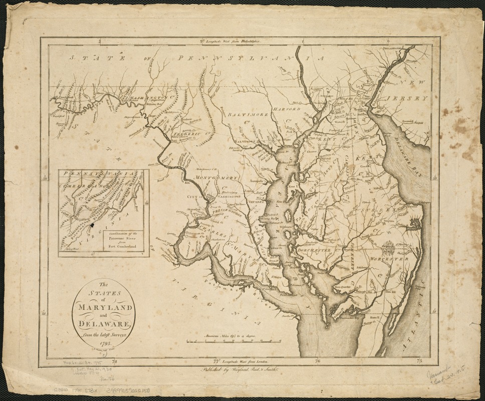
The states of Maryland and Delaware, from the latest surveys
This map is also available in American Revolutionary Geographies Online (ARGO), a collections portal especially built for material relating to the American Revolutionary War Era. Visit ARGO to learn more about this item and explore the historical geography of North America in the late eighteenth century.
Item Information
- Title:
- The states of Maryland and Delaware, from the latest surveys
- Engraver:
- Martin, D.
- Name on Item:
-
D. Martin, sculpt.
- Date:
-
[1796]
- Format:
-
Maps/Atlases
- Location:
-
Boston Public Library
Norman B. Leventhal Map Center - Collection (local):
-
Norman B. Leventhal Map Center Collection
- Subjects:
-
Maryland--Maps--Early works to 1800
Delaware--Maps--Early works to 1800
- Places:
-
Maryland
Delaware
- Extent:
- 1 map ; 35 x 42 cm.
- Terms of Use:
-
No known copyright restrictions.
No known restrictions on use.
- Publisher:
-
[New York] :
Wayland, Reid & Smith
- Scale:
-
Scale 1:800,000.
- Language:
-
English
- Notes:
-
Relief shown pictorially.
Inset: Continuation of the Potowmac River from Fort Cumberland.
Appears in John Reid's American Atlas. New York : John Reid, 1796.
- Notes (date):
-
This date is inferred.
- Identifier:
-
06_01_006288
- Call #:
-
G3840 1795 .S73x
- Barcode:
-
39999059022150


![[A map of part of Pennsylvania & Maryland intended to shew, at one view, the several places proposed for opening a communication between the waters of the Delaware & Chesopeak Bays]](https://bpldcassets.blob.core.windows.net/derivatives/images/commonwealth:z603vt12v/image_thumbnail_300.jpg)
