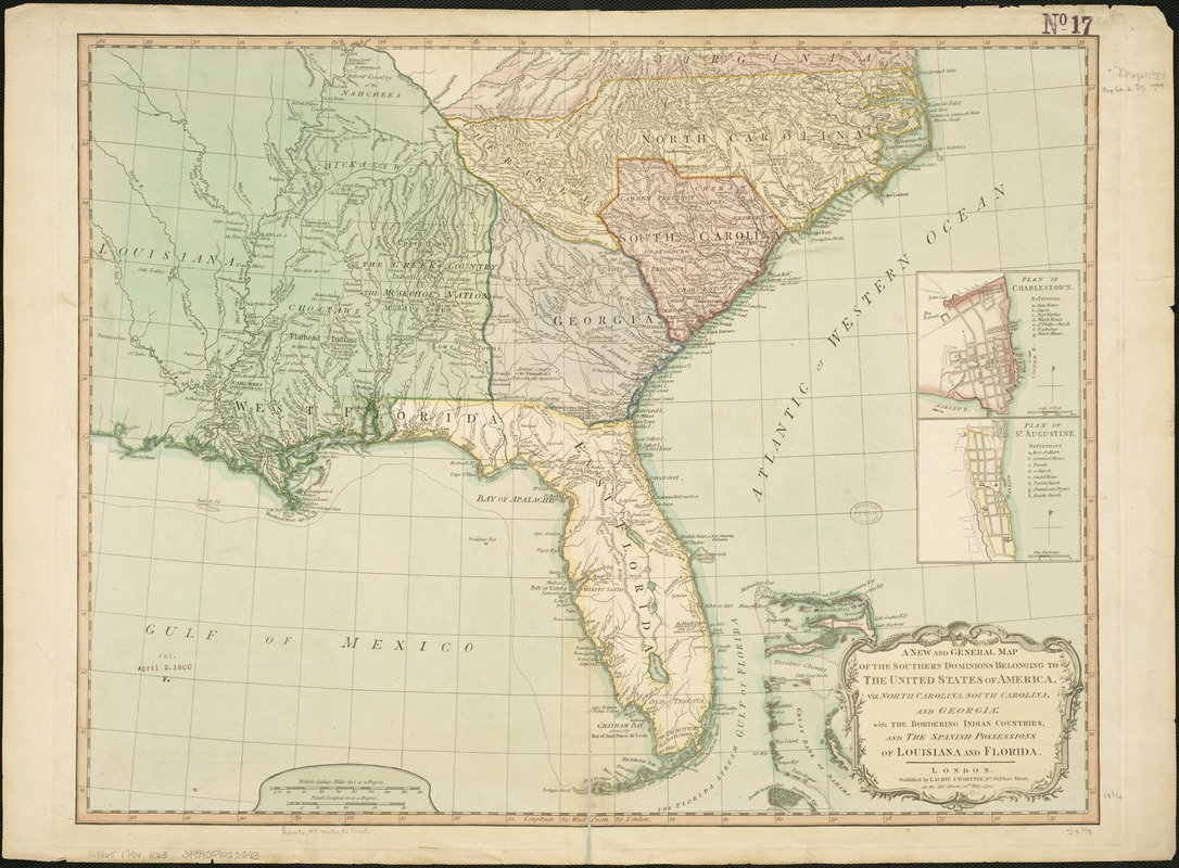
A new and general map of the Southern dominions belonging to the United States of America, viz North Carolina, South Carolina, and Georgia : with the bordering Indian countries, and the Spanish possessions of Louisiana and Florida
This map is also available in American Revolutionary Geographies Online (ARGO), a collections portal especially built for material relating to the American Revolutionary War Era. Visit ARGO to learn more about this item and explore the historical geography of North America in the late eighteenth century.
Item Information
- Title:
- A new and general map of the Southern dominions belonging to the United States of America, viz North Carolina, South Carolina, and Georgia : with the bordering Indian countries, and the Spanish possessions of Louisiana and Florida
- Creator:
- Robert Laurie and James Whittle
- Date:
-
1794
- Format:
-
Maps/Atlases
- Location:
-
Boston Public Library
Norman B. Leventhal Map Center - Collection (local):
-
Norman B. Leventhal Map Center Collection
- Subjects:
-
Indians of North America--South Atlantic States--Maps--Early works to 1800
Southern States--Maps--Early works to 1800
Charleston (S.C.)--Maps--Early works to 1800
Saint Augustine (Fla.)--Maps--Early works to 1800
- Places:
-
Charleston (county)Charleston
Georgia
North Carolina
Virginia
Saint Johns (county)Saint Augustine
- Extent:
- 1 map : hand col. ; 49 x 62 cm.
- Terms of Use:
-
No known copyright restrictions.
No known restrictions on use.
- Publisher:
-
London :
Laurie & Whittle
- Scale:
-
Scale [ca. 1:3,168,000]
- Language:
-
English
- Notes:
-
Relief shown pictorially.
Prime meridian: London.
Appears in Thomas Kitchin's New universal atlas exhibiting all the empires, kingdoms, states, republics &c., &c.
Includes 2 insets with reference lists: Plan of Charlestown -- Plan of St. Augustine.
- Identifier:
-
06_01_006283
- Call #:
-
G3865 1794 .R63
- Barcode:
-
39999059022093


![[Map of Florida, Carolina, and the Gulf Coast]](https://bpldcassets.blob.core.windows.net/derivatives/images/commonwealth:z603vr379/image_thumbnail_300.jpg)

