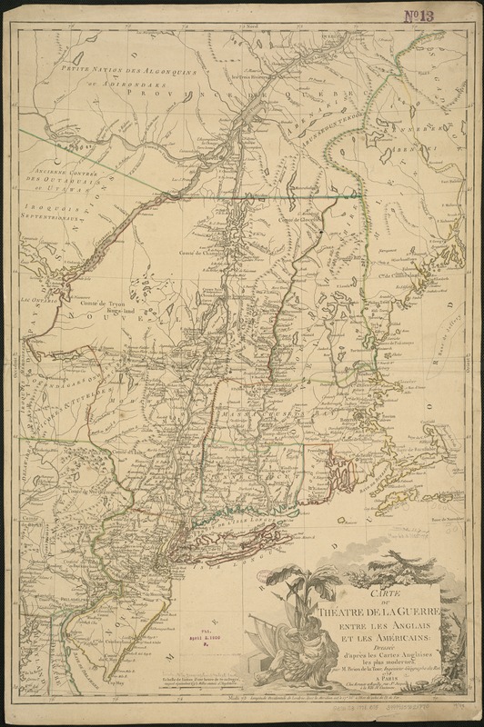
Carte du théatre de la guerre entre les Anglais et les Américains
This map is also available in American Revolutionary Geographies Online (ARGO), a collections portal especially built for material relating to the American Revolutionary War Era. Visit ARGO to learn more about this item and explore the historical geography of North America in the late eighteenth century.
Item Information
- Title:
- Carte du théatre de la guerre entre les Anglais et les Américains
- Creator:
- Brion de la Tour, Louis.
- Name on Item:
-
dressée d'après les cartes Anglaises les plus modernes par M. Brion de la Tour.
- Date:
-
1778
- Format:
-
Maps/Atlases
- Location:
-
Boston Public Library
Norman B. Leventhal Map Center - Collection (local):
-
Norman B. Leventhal Map Center Collection
- Subjects:
-
Northeastern States--Maps--Early works to 1800
United States--History--Revolution, 1775-1783--Maps--Early works to 1800
- Places:
-
Northeastern United States (area)
- Extent:
- 1 map : outline col. ; 74 x 50 cm.
- Terms of Use:
-
No known copyright restrictions.
No known restrictions on use.
- Publisher:
-
A Paris :
Chez Esnauts et Rapilly
- Scale:
-
Scale 1:1,210,000.
- Language:
-
French
- Notes:
-
Relief shown pictorially.
State 3 with change of date and numerous additions in Philadelphia area and New Jersey.
- Identifier:
-
06_01_006271
- Call #:
-
G3711.S3 1778 .B75
- Barcode:
-
39999059021970


