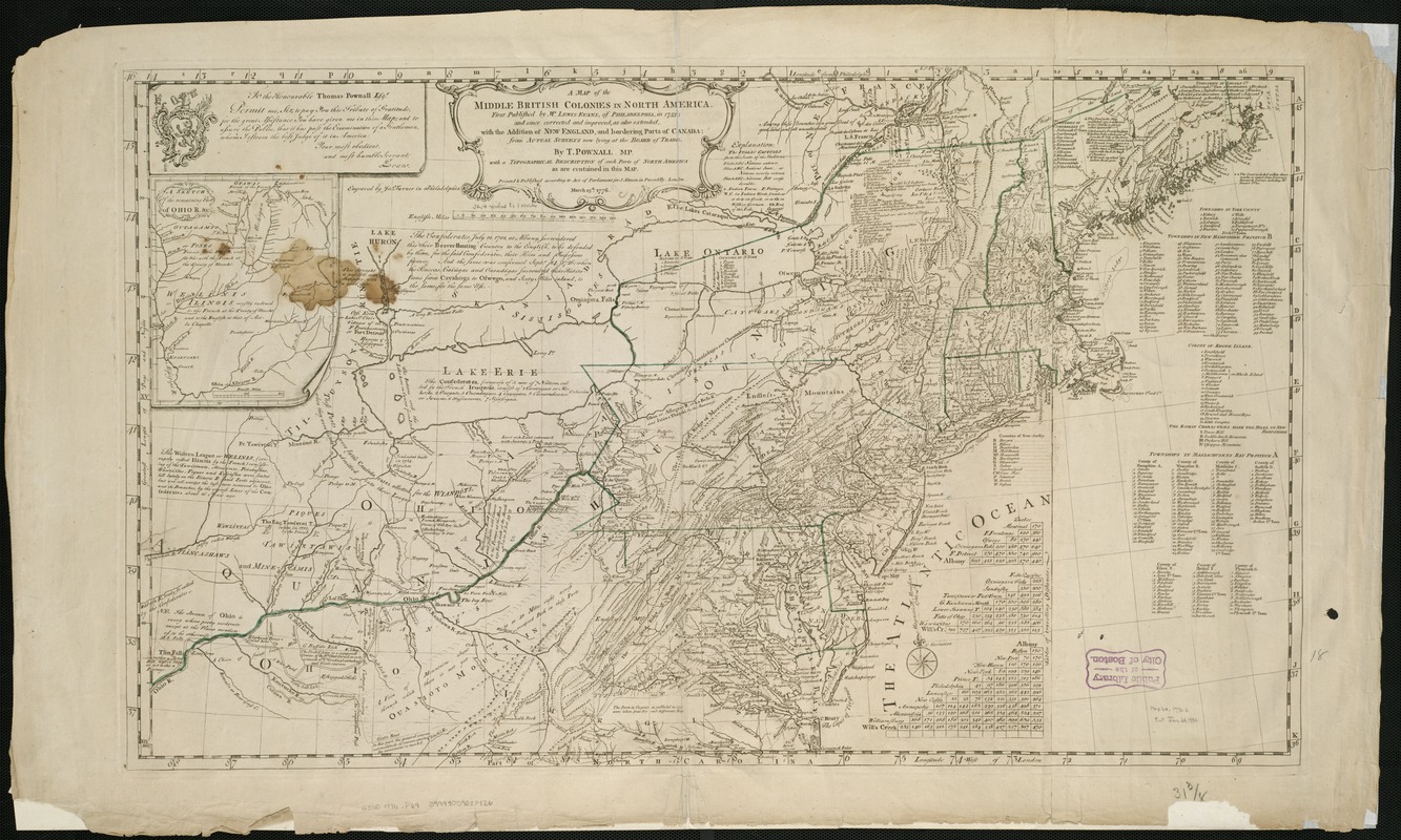
A map of the middle British colonies in North America : first published by Mr. Lewis Evans, of Philadelphia, in 1755; and since corrected and improved, as also extended, with the addition of New England, and bordering parts of Canada; from actual surveys now lying at the Board of Trade
This map is also available in American Revolutionary Geographies Online (ARGO), a collections portal especially built for material relating to the American Revolutionary War Era. Visit ARGO to learn more about this item and explore the historical geography of North America in the late eighteenth century.
Item Information
- Title:
- A map of the middle British colonies in North America : first published by Mr. Lewis Evans, of Philadelphia, in 1755; and since corrected and improved, as also extended, with the addition of New England, and bordering parts of Canada; from actual surveys now lying at the Board of Trade
- Title (alt.):
-
A Topographical description of such parts of North America as are contained in the (annexed) map of the Middle British Colonies, &c. in North America
- Creator:
- Pownall, Thomas, 1722-1805
- Name on Item:
-
by T. Pownall, mp. ;engraved by Jas. Turner in Philadelphia.
- Date:
-
1776
- Format:
-
Maps/Atlases
- Location:
-
Boston Public Library
Norman B. Leventhal Map Center - Collection (local):
-
Norman B. Leventhal Map Center Collection
- Subjects:
-
Northeastern States--Maps--Early works to 1800
Great Britain--Territories and possessions--Maps--Early works to 1800
- Places:
-
Northeastern United States (area)
- Extent:
- 1 map ; 49 x 80 cm.
- Terms of Use:
-
No known copyright restrictions.
No known restrictions on use.
- Publisher:
-
London :
Printed & published ... for J. Almon
- Scale:
-
Scale ca. 1:2,350,000
- Language:
-
English
- Notes:
-
Relief shown pictorially.
Prime meridian: London and Philadelphia.
Includes text, list of townships, distance charts, and inset "A sketch of the remaining part of Ohio R. &c."
- Identifier:
-
06_01_006217
- Call #:
-
G3710 1776 .P69
- Barcode:
-
39999059021426


