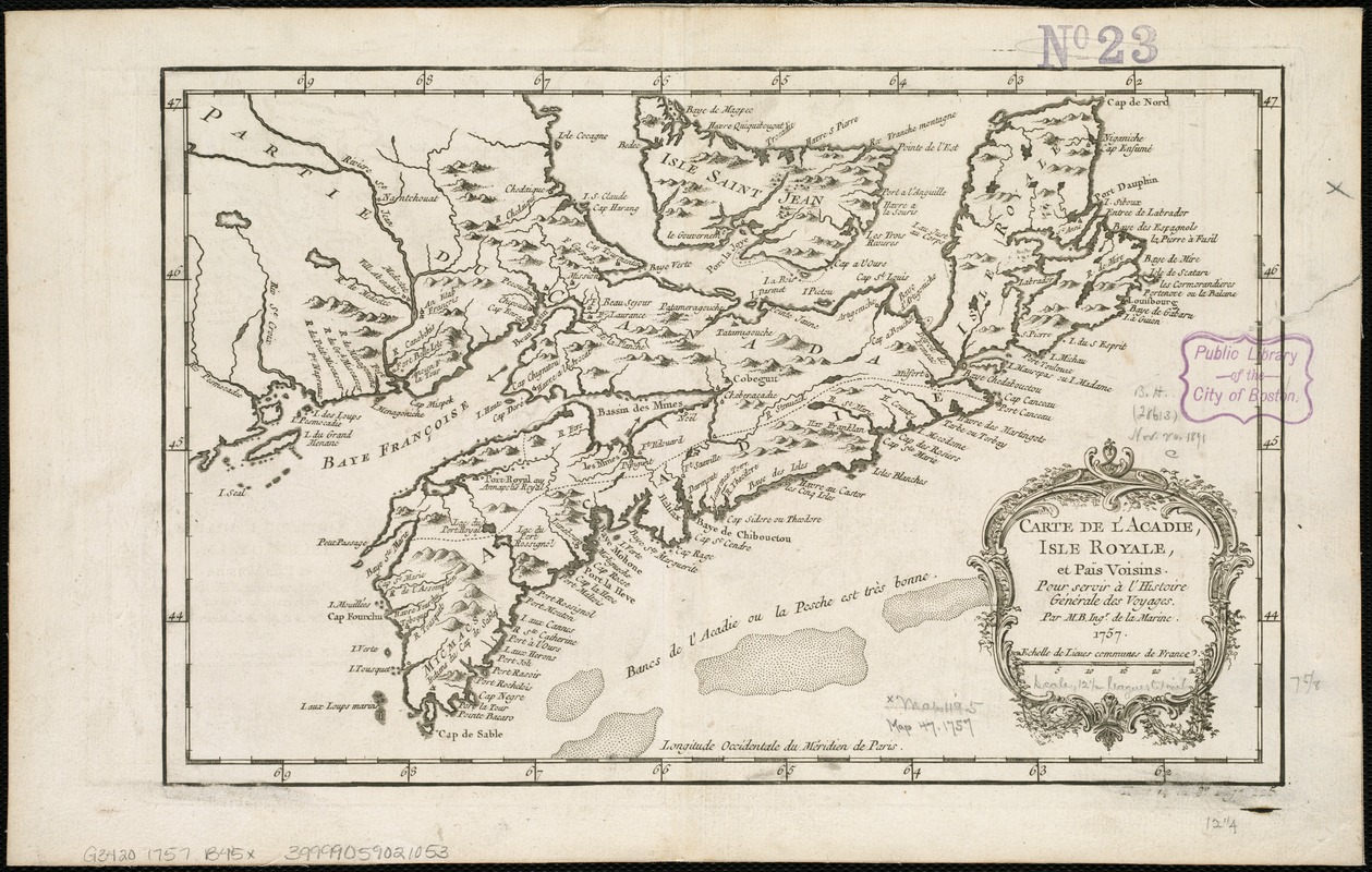
Carte de l'Acadie, Isle Royale, et Païs Voisins : pour servir à l'Histoire Générale des voyages
This map is also available in American Revolutionary Geographies Online (ARGO), a collections portal especially built for material relating to the American Revolutionary War Era. Visit ARGO to learn more about this item and explore the historical geography of North America in the late eighteenth century.
Item Information
- Title:
- Carte de l'Acadie, Isle Royale, et Païs Voisins : pour servir à l'Histoire Générale des voyages
- Creator:
- Bellin, Jacques Nicolas, 1703-1772
- Name on Item:
-
par M. B. Ingr. de la marine.
- Date:
-
1757
- Format:
-
Maps/Atlases
- Location:
-
Boston Public Library
Norman B. Leventhal Map Center - Collection (local):
-
Norman B. Leventhal Map Center Collection
- Subjects:
-
Nova Scotia--Maps--Early works to 1800
- Places:
-
CanadaNova Scotia (province)
- Extent:
- 1 map ; 20 x 32 cm.
- Terms of Use:
-
No known copyright restrictions.
No known restrictions on use.
- Publisher:
-
Paris? :
[s.n.]
- Scale:
-
Scale ca. 1:2,250,000.
- Language:
-
French
- Notes:
-
Relief shown pictorially.
Cataloging, conservation, and digitization made possible in part by The National Endowment for the Humanities: Exploring the human endeavor.
- Identifier:
-
06_01_006177
- Call #:
-
G3420 1757 .B45x
- Barcode:
-
39999059021053


