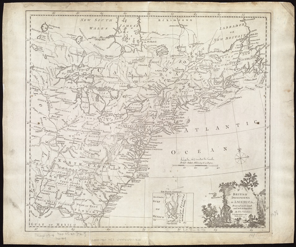
British dominions in America, drawn from the latest and best authorities
This map is also available in American Revolutionary Geographies Online (ARGO), a collections portal especially built for material relating to the American Revolutionary War Era. Visit ARGO to learn more about this item and explore the historical geography of North America in the late eighteenth century.
Item Information
- Title:
- British dominions in America, drawn from the latest and best authorities
- Creator:
- Kitchin, Thomas, d. 1784
- Name on Item:
-
by Thos. Kitchin.
- Date:
-
[1750–1800]
- Format:
-
Maps/Atlases
- Location:
-
Boston Public Library
Norman B. Leventhal Map Center - Collection (local):
-
Norman B. Leventhal Map Center Collection
- Subjects:
-
North America--Maps--Early works to 1800
United States--Maps--Early works to 1800
Canada--Maps--Early works to 1800
- Places:
-
North America (area)
United States
Canada
- Extent:
- 1 map ; 33 x 36 cm.
- Terms of Use:
-
No known copyright restrictions.
No known restrictions on use.
- Publisher:
-
London :
s.n.
- Scale:
-
Scale ca. 1:9,504,000
- Language:
-
English
- Notes:
-
Prime meridian: [London?].
Relief shown pictorially.
Inset: East Florida continued.
Title in pictorial cartouche.
Shows areas occupied by many Native American tribes.
- Notes (date):
-
This date is inferred.
- Identifier:
-
06_01_006160
- Call #:
-
G3300 1750 .K57
- Barcode:
-
39999059020832


