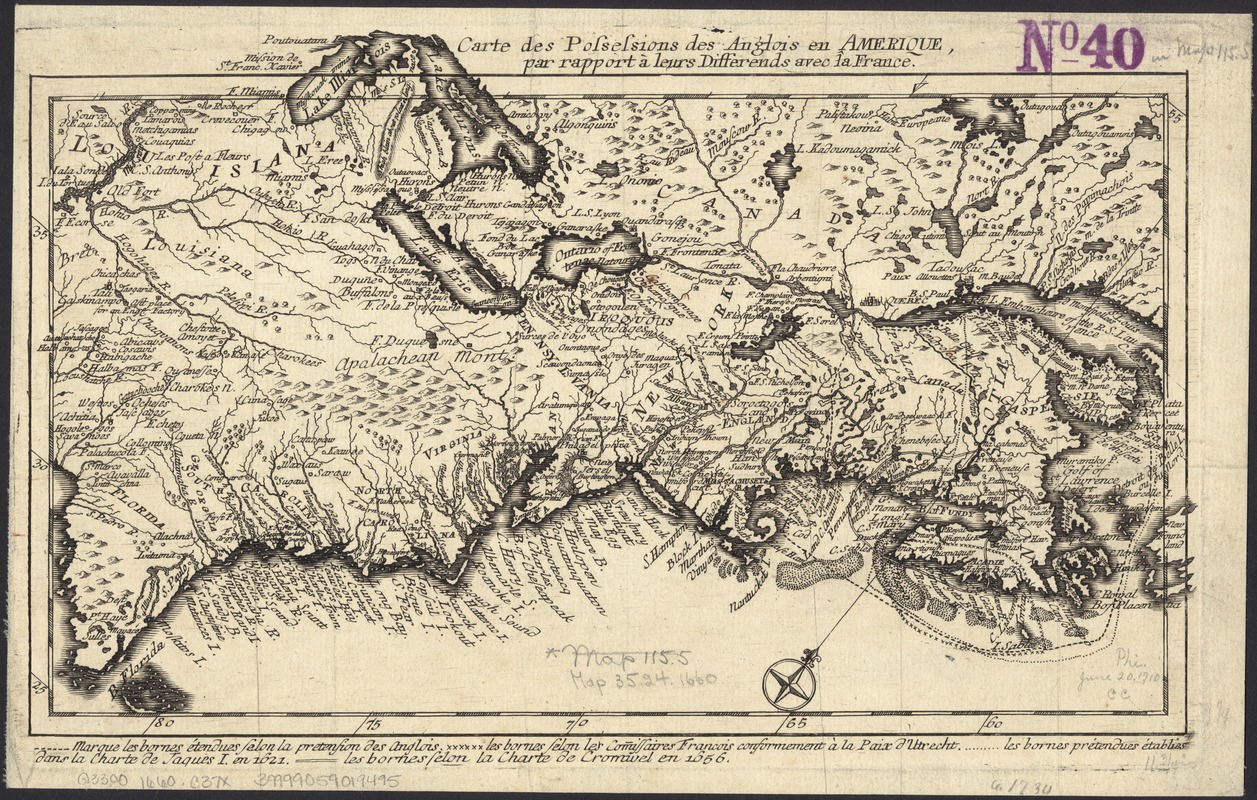
Carte des possessions des Anglois en Amerique, par rapport à leurs differends avec la France
This map is also available in American Revolutionary Geographies Online (ARGO), a collections portal especially built for material relating to the American Revolutionary War Era. Visit ARGO to learn more about this item and explore the historical geography of North America in the late eighteenth century.
Item Information
- Title:
- Carte des possessions des Anglois en Amerique, par rapport à leurs differends avec la France
- Creator:
- Back, Jean Conr. (Jean Conrad)
- Date:
-
[1759?]
- Format:
-
Maps/Atlases
- Location:
-
Boston Public Library
Norman B. Leventhal Map Center - Collection (local):
-
Norman B. Leventhal Map Center Collection
- Subjects:
-
North America--Maps--Early works to 1800
- Places:
-
North America (area)
- Extent:
- 1 map ; 18 x 30 cm.
- Terms of Use:
-
No known copyright restrictions.
No known restrictions on use.
- Publisher:
-
Zwolle :
Guillaume Meyer
- Scale:
-
Scale not given.
- Language:
-
English
French
- Notes:
-
Relief shown pictorially.
Oriented with north toward the upper right.
Shows boundary lines.
- Identifier:
-
06_01_006086
- Call #:
-
G3300 1759 .B33x
- Barcode:
-
39999059019495


