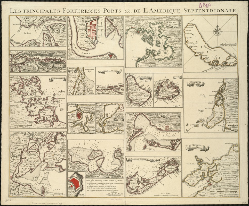
Les principales forteresses, ports &c. de l'Amérique septentrionale
This map is also available in American Revolutionary Geographies Online (ARGO), a collections portal especially built for material relating to the American Revolutionary War Era. Visit ARGO to learn more about this item and explore the historical geography of North America in the late eighteenth century.
Item Information
- Title:
- Les principales forteresses, ports &c. de l'Amérique septentrionale
- Creator:
- Cóvens et Mortier
- Date:
-
[1745?]
- Format:
-
Maps/Atlases
- Location:
-
Boston Public Library
Norman B. Leventhal Map Center - Collection (local):
-
Norman B. Leventhal Map Center Collection
- Subjects:
-
Harbors--Atlantic coast (North America)--Maps--Early works to 1800
North America--Maps--Early works to 1800
- Places:
-
North America (area)
- Extent:
- 18 maps on 1 sheet : hand col. ; 17 x 15 cm. or smaller, sheet 54 x 66 cm.
- Terms of Use:
-
No known copyright restrictions.
No known restrictions on use.
- Publisher:
-
Amsterdam :
Chez Jean Covens & Corneille Mortier
- Scale:
-
Scales differ.
- Language:
-
French
English
- Table of Contents:
-
The harbour of Placentia
The harbour of Anapolis Royal
Boston Harbour
New York and Perthamboy Harbour
The town and harbour of Charles Town in South Carolina
Harbour of St. Augustine
The Harbour of Providence
The Havana
Bay of St. Iago in Cuba
A plan of the harbour of Port Antonio in Jamaica
Fort Royal in Martinica
The Island of Barbadoes
Antigua
Kingston Harbour in Jamaica [with the fort's plan in inset]
The Bermuda or Summer Islands
Curaçao
Cartagene on the coast of New Spain
Harbour of Porto Bello.
- Notes:
-
Relief shown pictorially and depths shown by soundings.
Appears in Covens & Mortier's Atlas Noveau, contenant toutes les Parties du Monde.
In lower right margin: I.K. s.
In English, with title in French.
- Identifier:
-
06_01_005998
- Call #:
-
G3300 1745 .C6
- Barcode:
-
39999059018968


