Preliminary plan for widening Chestnut Hill Avenue
Item Information
- Title:
- Preliminary plan for widening Chestnut Hill Avenue
- Creator:
- F.L. Olmsted and Company
- Name on Item:
-
F.L. Olmsted & Co.
- Date:
-
1891
- Format:
-
Maps/Atlases
- Location:
-
Boston Public Library
Norman B. Leventhal Map Center - Collection (local):
-
Norman B. Leventhal Map Center Collection
- Subjects:
-
Brookline (Mass.)--Maps
- Places:
-
Norfolk (county)Brookline
- Extent:
- 1 map ; 35 x 113 cm.
- Terms of Use:
-
No known copyright restrictions.
No known restrictions on use.
- Publisher:
-
Brookline, Mass :
F.L. Olmsted & Co.
- Scale:
-
Scale 1:1,200.
- Language:
-
English
- Notes:
-
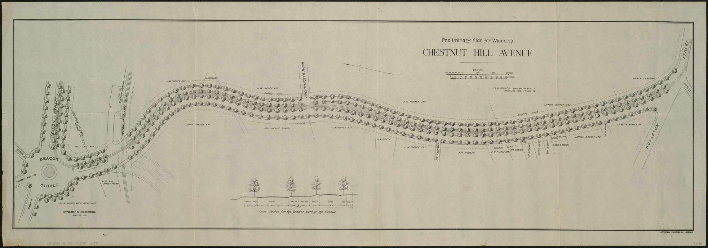
Detailed plan for the widening of Chestnut Hill Avenue, between Beacon Street and Boylston Street, just across the Reservoir from Boston College.
"Supplement to the Chronicle June 20, 1891."
- Identifier:
-
06_01_005960
- Call #:
-
G3764.B9 1891 .F5
- Barcode:
-
39999059018877


