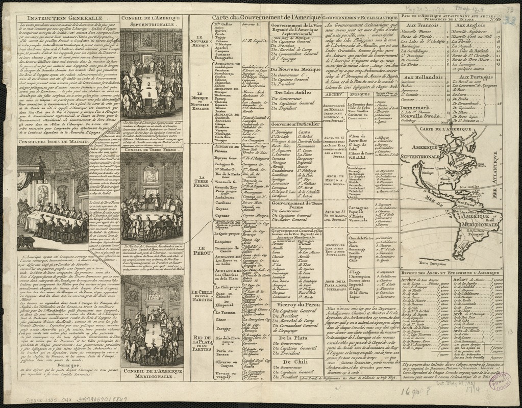
Carte du Gouvernement de l'Amerique
Item Information
- Title:
- Carte du Gouvernement de l'Amerique
- Creator:
- Chatelain, Henri Abraham.
- Name on Item:
-
Henry Abraham Chatelain.
- Date:
-
[1705–1720]
- Format:
-
Maps/Atlases
- Location:
-
Boston Public Library
Norman B. Leventhal Map Center - Collection (local):
-
Norman B. Leventhal Map Center Collection
- Subjects:
-
America--History--18th century--Maps--Early works to 1800
America--Maps--Early works to 1800
Western Hemisphere--Maps--Early works to 1800
- Places:
-
North and Central America
South America
Mesoamerica (area)
North America (area)
South America
America
- Extent:
- 1 sheet ; 43 x 33 cm.
- Terms of Use:
-
No known copyright restrictions.
No known restrictions on use.
- Publisher:
-
Amsterdam :
F. L'Honorié & Châtelain
- Scale:
-
Scale not given.
- Language:
-
French
- Notes:
-
Sheet consists of French text, statistics and four engravings showing councils of colonial powers dividing America among themselves.
Inset: Carte de l'Amerique: 13 x 9 cm.
No. 35 in upper right corner.
- Notes (date):
-
This date is inferred.
- Identifier:
-
06_01_005959
- Call #:
-
G3290 1705 .C4x
- Barcode:
-
39999059018869


