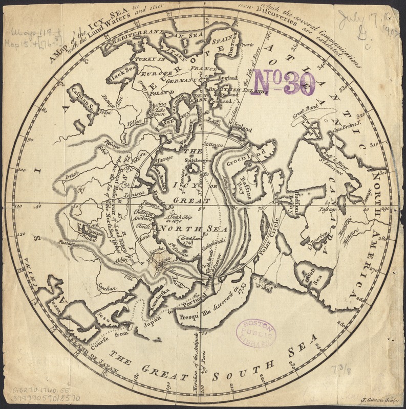
A map of the icy sea in which the several communications with the land waters and other new discoveries are exhibited
Item Information
- Title:
- A map of the icy sea in which the several communications with the land waters and other new discoveries are exhibited
- Creator:
- Gibson, J. (John), fl. 1750-1792
- Name on Item:
-
J. Gibson, sculpt.
- Date:
-
[1760]
- Format:
-
Maps/Atlases
- Location:
-
Boston Public Library
Norman B. Leventhal Map Center - Collection (local):
-
Norman B. Leventhal Map Center Collection
- Subjects:
-
Arctic regions--Maps--Early works to 1800
North Pole--Maps--Early works to 1800
- Places:
-
Arctic (area)
- Extent:
- 1 map : col. ; 19 cm. in diam., on sheet 21 x 22 cm.
- Terms of Use:
-
No known copyright restrictions.
No known restrictions on use.
- Publisher:
-
London :
Gentleman's Magazine
- Scale:
-
Scale not given.
- Language:
-
English
- Notes:
-
From: Gentleman's magazine, v.30, June 1760 opp. p. 284.
Polar projection showing the "icy great North Sea" south to mid Asia and America.
- Notes (date):
-
This date is inferred.
- Identifier:
-
06_01_005923
- Call #:
-
G3270 1760 .G5
- Barcode:
-
39999059018570