United States
Item Information
- Title:
- United States
- Description:
-
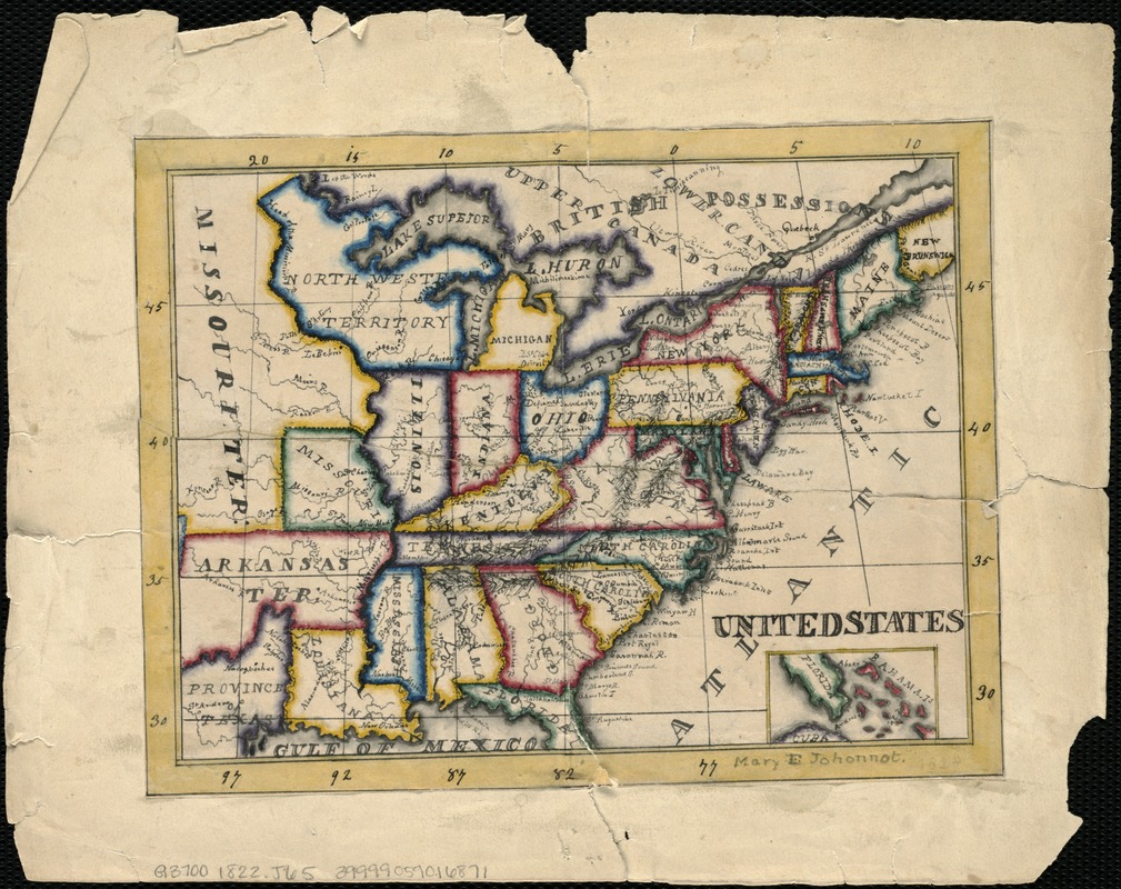
During the late 18th and early 19th century, it was common practice for American female students attending private academies to prepare maps of various parts of the world by copying maps from books or atlases. Most often, girls were taught by female instructors, who drew maps themselves to demonstrate geographic, artistic and design skills to their pupils. This map of the United States, drawn by Mary E. Johonnot of Boston, was most likely compiled in the 1820s as a school geography project, and was based on an earlier map as evidenced by the missing borders of Arkansas and Missouri.
- Creator:
- Johonnot, Mary E.
- Name on Item:
-
Mary E. Johonnot.
- Date:
-
[1822]
- Format:
-
Maps/Atlases
Manuscripts
- Location:
-
Boston Public Library
Norman B. Leventhal Map Center - Collection (local):
-
Norman B. Leventhal Map Center Collection
- Subjects:
-
United States--Maps, Manuscript
- Places:
-
- Extent:
- 1 ms. map : col. ; 14 x 19 cm.
- Terms of Use:
-
No known copyright restrictions.
No known restrictions on use.
- Scale:
-
Not drawn to scale.
- Language:
-
English
- Notes:
-
Relief shown pictorially.
Includes inset of part of Florida, the Bahamas and part of Cuba.
Manuscript map in pen-and-ink and watercolor, drawn by a schoolgirl.
- Notes (date):
-
This date is inferred.
- Notes (exhibitions):
-
Exhibited: "Women in Cartography: Five Centuries of Accomplishments" organized by the Norman B. Leventhal Map Center at the Boston Public Library, 2015-2016.
- Identifier:
-
06_01_005740
- Call #:
-
G3700 1822 .J65
- Barcode:
-
39999059016871


