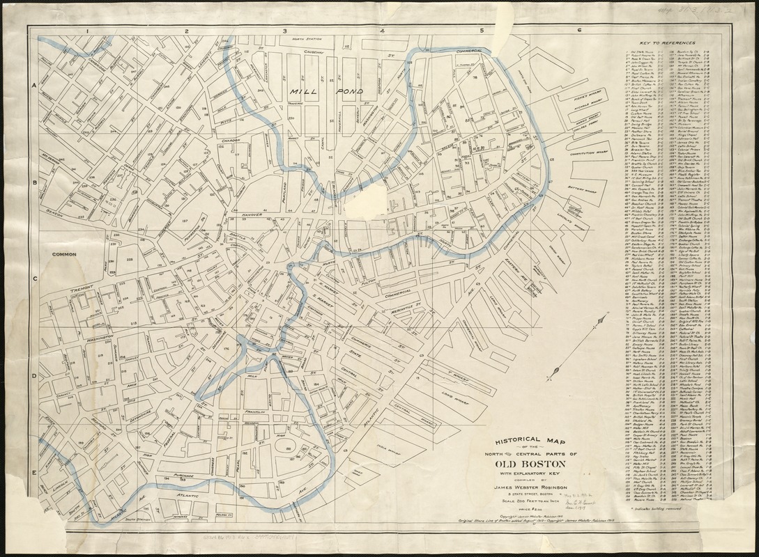
Historical map of the north and central parts of Old Boston with explanatory key
Item Information
- Title:
- Historical map of the north and central parts of Old Boston with explanatory key
- Creator:
- Robinson, James Webster.
- Name on Item:
-
compiled by James Webster Robinson.
- Date:
-
[ca. 1913]
- Format:
-
Maps/Atlases
- Location:
-
Boston Public Library
Norman B. Leventhal Map Center - Collection (local):
-
Norman B. Leventhal Map Center Collection
- Subjects:
-
Boston (Mass.)--History--Maps
- Places:
-
Suffolk (county)Boston
- Extent:
- 1 map ; 63 x 88 cm.
- Terms of Use:
-
No known copyright restrictions.
No known restrictions on use.
- Publisher:
-
Boston :
s.n.
- Edition:
- [2nd ed.]
- Scale:
-
Scale 1:2,400.
- Language:
-
English
- Notes:
-
Oriented with north toward the upper right.
"Original shore line of Boston added 1913."
Includes index to historic places of interest.
- Identifier:
-
06_01_005490
- Call #:
-
G3764.B6 1913 .R6x
- Barcode:
-
39999059014694


