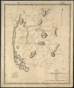
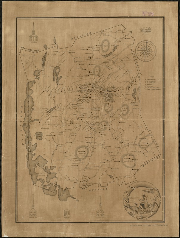
A Map of the town of Shrewsbury, Mass
Item Information
- Title:
- A Map of the town of Shrewsbury, Mass
- Creator:
- Parker, L. M.
- Name on Item:
-
compiled and published by L.M. Parker.
- Date:
-
1859
- Format:
-
Maps/Atlases
- Location:
-
Boston Public Library
Norman B. Leventhal Map Center - Collection (local):
-
Norman B. Leventhal Map Center Collection
- Subjects:
-
Landowners--Massachusetts--Shrewsbury--Maps
Shrewsbury (Mass.)--Maps
- Places:
-
MassachusettsWorcester (county)Shrewsbury
- Extent:
- 1 map : ill. ; 57 x 41 cm.
- Terms of Use:
-
No known copyright restrictions.
No known restrictions on use.
- Publisher:
-
[Shrewsbury, Mass.?] :
L.M. Parker
- Scale:
-
Scale not given.
- Language:
-
English
- Notes:
-
Relief shown by hachures.
Shows drawings of three churches, Central Hall and School #1, and L.M. Parker residence. Also sketch of L.M. Parker sketching town scenes, with dog. Shows buildings, and names of shops and homeowners.
Distance from town common shown by cocentric circles at half mile intervals.
Meisel Brothers Lith., Boston.
- Identifier:
-
06_01_005485
- Call #:
-
G3764.S38G46 1859 .P3x
- Barcode:
-
39999059014637