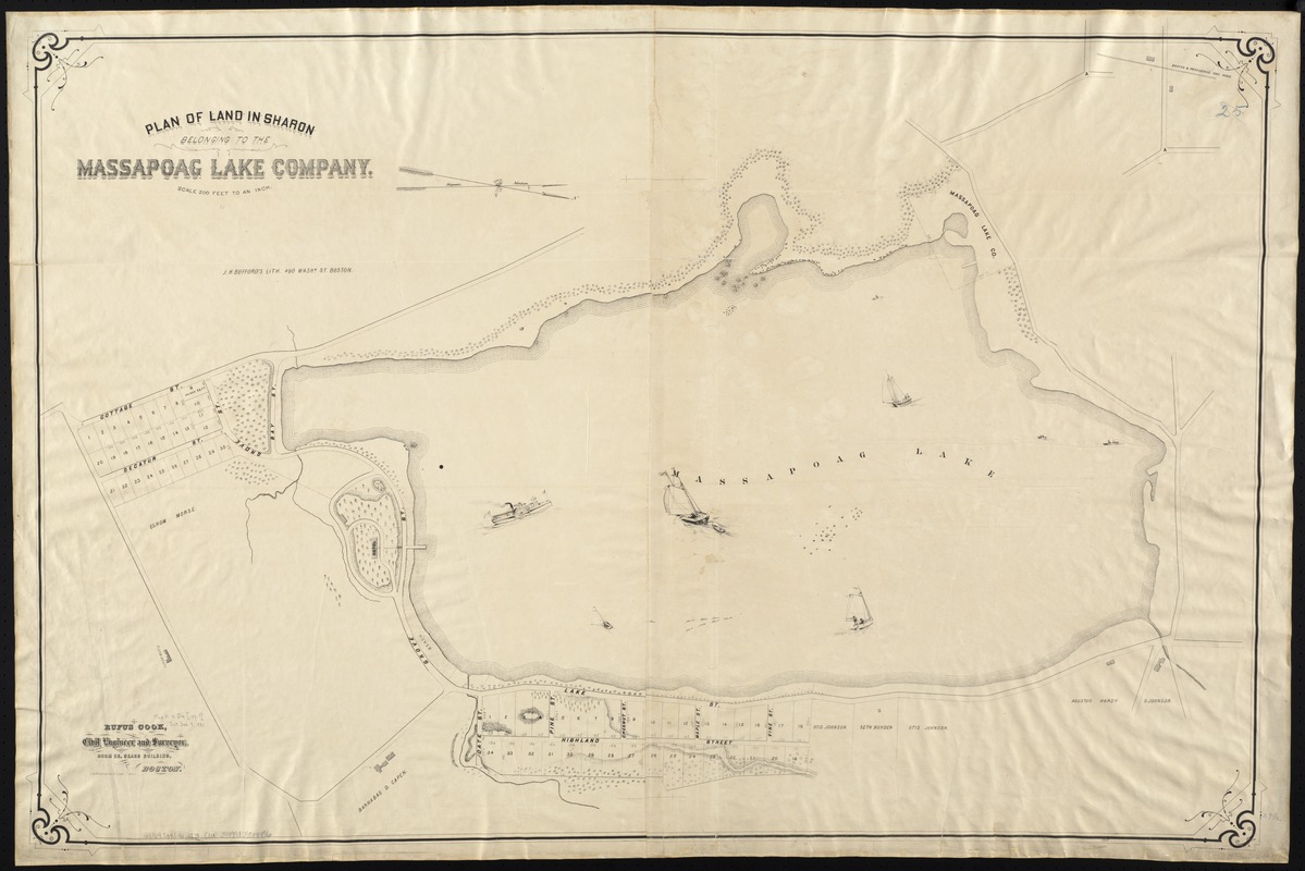
Plan of land in Sharon belonging to the Massapoag Lake Company
Item Information
- Title:
- Plan of land in Sharon belonging to the Massapoag Lake Company
- Creator:
- Cook, Rufus.
- Name on Item:
-
Rufus Cook, civil engineer and surveyor.
- Date:
-
[1870–1880]
- Format:
-
Maps/Atlases
- Location:
-
Boston Public Library
Norman B. Leventhal Map Center - Collection (local):
-
Norman B. Leventhal Map Center Collection
- Subjects:
-
Real property--Massachusetts--Sharon--Maps
Sharon (Mass.)--Maps
- Places:
-
Norfolk (county)Sharon
- Extent:
- 1 map ; 75 x 114 cm.
- Terms of Use:
-
No known copyright restrictions.
No known restrictions on use.
- Publisher:
-
Boston :
J.H. Bufford's Lith.
- Scale:
-
Scale 1:2,400.
- Language:
-
English
- Notes:
-
Oriented with north toward the lower right.
Relief shown by hachures.
- Notes (date):
-
This date is inferred.
- Identifier:
-
06_01_005468
- Call #:
-
G3764.S34G46 1870 .C6x
- Barcode:
-
39999059014496