Plan of lands of Wollaston Land Associates at Wollaston Heights, Quincy
Item Information
- Title:
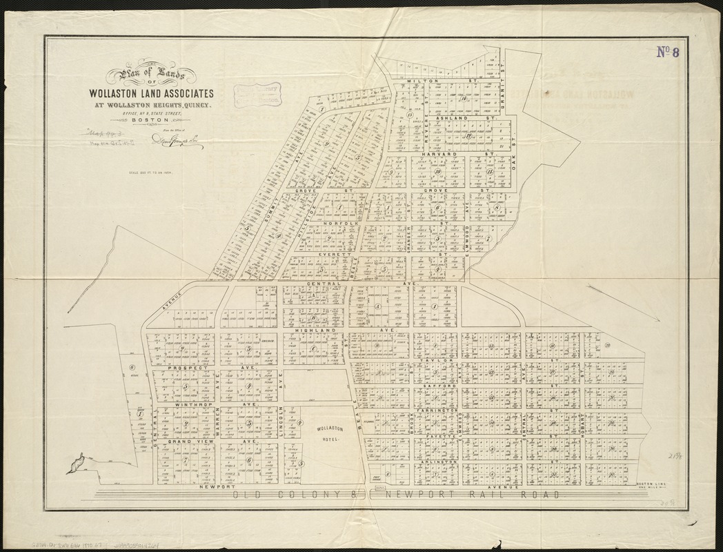
- Plan of lands of Wollaston Land Associates at Wollaston Heights, Quincy
- Creator:
- David Granger & Son
- Name on Item:
-
from the office of David Granger & Son.
- Date:
-
[1870?]
- Format:
-
Maps/Atlases
- Location:
-
Boston Public Library
Norman B. Leventhal Map Center - Collection (local):
-
Norman B. Leventhal Map Center Collection
- Subjects:
-
Real property--Massachusetts--Quincy--Maps
Wollaston (Quincy, Mass.)--Maps
Quincy (Mass.)--Maps
Wollaston (Quincy, Mass.)
- Places:
-
Norfolk (county)QuincyWollaston
- Extent:
- 1 map ; 57 x 76 cm.
- Terms of Use:
-
No known copyright restrictions.
No known restrictions on use.
- Publisher:
-
Boston :
[Wollaston Land Associates]
- Scale:
-
Scale [1:2,400].
- Language:
-
English
- Notes:
-
Oriented with north toward the lower right.
Cadastral map showing lot numbers, dimensions, and areas.
Cover area Milton St. to Newport Ave., Hobart St. to Summit Ave.
- Identifier:
-
06_01_005431
- Call #:
-
G3764.Q6:2W6G46 1870 .G7
- Barcode:
-
39999059014264