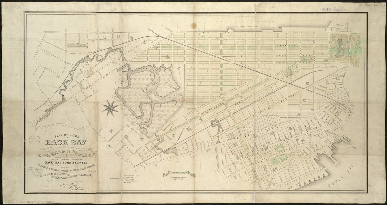
Plan of lands on the Back Bay, belonging to the Boston Water Power Co., the Commonwealth, and other parties, showing the system of streets, grades and sewers as laid out and recommended by the Back Bay Commissioners
Item Information
- Title:
- Plan of lands on the Back Bay, belonging to the Boston Water Power Co., the Commonwealth, and other parties, showing the system of streets, grades and sewers as laid out and recommended by the Back Bay Commissioners
- Creator:
- Back Bay (Boston (Mass.). Commissioners
- Name on Item:
-
compiled and surveyed under the direction of the Commissioners.
- Date:
-
1861
- Format:
-
Maps/Atlases
- Location:
-
Boston Public Library
Norman B. Leventhal Map Center - Collection (local):
-
Norman B. Leventhal Map Center Collection
- Subjects:
-
Boston Water Power Company--Maps
Real property--Massachusetts--Boston--Back Bay--Maps
Back Bay (Boston, Mass.)--Maps
- Places:
-
Suffolk (county)BostonBack Bay
- Extent:
- 1 map : col. ; 67 x 128 cm.
- Terms of Use:
-
No known copyright restrictions.
No known restrictions on use.
- Publisher:
-
Boston :
[A. Meisel]
- Scale:
-
Scale 1:3,600.
- Language:
-
English
- Notes:
-
Oriented with north toward the upper right.
'"This plan also includes portion of the adjacent territory in the cities of Boston and Roxbury and in the town of Brookline."
- Identifier:
-
06_01_005397
- Call #:
-
G3764.B6:2B2G46 1861 .B67
- Barcode:
-
39999059013795


