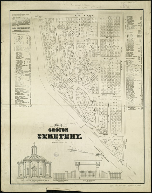
Plan of Groton Cemetery
Item Information
- Title:
- Plan of Groton Cemetery
- Date:
-
[1855?]
- Format:
-
Maps/Atlases
- Location:
-
Boston Public Library
Norman B. Leventhal Map Center - Collection (local):
-
Norman B. Leventhal Map Center Collection
- Subjects:
-
Cemeteries--Massachusetts--Groton (Town)--Maps
Groton (Mass. : Town)--Maps
- Places:
-
Middlesex (county)Groton
- Extent:
- 1 map ; 64 x 49 cm.
- Terms of Use:
-
No known copyright restrictions.
No known restrictions on use.
- Publisher:
-
Boston :
S.W. Chandler & Bro.
- Scale:
-
Scale not given.
- Language:
-
English
- Notes:
-
Oriented with north toward the upper left.
Shows plot numbers, paths, and avenues.
Includes name index of proprietors of lots, note, and 3 views: Plan for a temple to be located on the circular area in sect. 16, Fence for the north & south lines, and Plan of the front entrance.
- Identifier:
-
06_01_005339
- Call #:
-
G3764.G86 1855 .P5x
- Barcode:
-
39999059013225