Map of the city of Cambridge, Middlesex County, Massachusetts
Item Information
- Title:
- Map of the city of Cambridge, Middlesex County, Massachusetts
- Creator:
- Walling, Henry Francis, 1825-1888
- Name on Item:
-
by H.F. Walling, city engineer ; engraved on stone by Friend & Aub.
- Date:
-
1854
- Format:
-
Maps/Atlases
- Location:
-
Boston Public Library
Norman B. Leventhal Map Center - Collection (local):
-
Norman B. Leventhal Map Center Collection
- Subjects:
-
Real property--Massachusetts--Cambridge--Maps
Landowners--Massachusetts--Cambridge--Maps
Cambridge (Mass.)--Maps
- Places:
-
Middlesex (county)Cambridge
- Extent:
- 1 map : hand col. ; 94 x 116 cm.
- Terms of Use:
-
No known copyright restrictions.
No known restrictions on use.
- Publisher:
-
Boston :
Geo. L. Dix
- Scale:
-
Scale 1:6,000.
- Language:
-
English
- Notes:
-
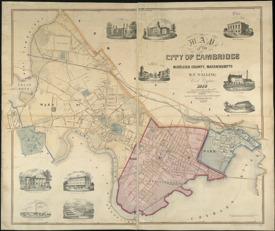
Relief shown by hachures.
Shows city wards, railroads, and some buildings and property owners.
In lower right margin: Entered according to Act of Congress by H.F. Walling in the Clerk's office of the Dist. Court of Massachusetts, A.D. 1854.
Includes 10 views of buildings: Gore Hall, Harvard University -- Court House, East Cambridge -- Athenaeum, Cambridgeport -- First Evangelical Congregational Church, Prospect St. Cambridgeport -- Riverside, Cambridgeport -- Bank and Porter's Hotel, North Cambridge -- Dane Hall, Harvard University -- Harvard Buildings, Old Cambridge -- New England Glass Works, East Cambridge -- C. Davenport & Co.'s Car Works, Cambridgeport.
- Identifier:
-
06_01_005315
- Call #:
-
G3764.C2 1854 .W3x
- Barcode:
-
39999059012896


