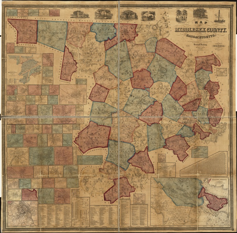
Map of Middlesex County, Massachusetts : based upon the trigonometrical survey of the state
Item Information
- Title:
- Map of Middlesex County, Massachusetts : based upon the trigonometrical survey of the state
- Creator:
- Walling, Henry Francis, 1825-1888
- Name on Item:
-
the details from original surveys under the direction of Henry F. Walling, supt. of the state map ; Thos. W. Baker, draughtsman.
- Date:
-
1856
- Format:
-
Maps/Atlases
- Location:
-
Boston Public Library
Norman B. Leventhal Map Center - Collection (local):
-
Norman B. Leventhal Map Center Collection
- Subjects:
-
Real property--Massachusetts--Middlesex County--Maps
Landowners--Massachusetts--Middlesex County--Maps
Cities and towns--Massachusetts--Middlesex County--Maps
Middlesex County (Mass.)--Maps
- Places:
-
Middlesex (county)
- Extent:
- 1 map : hand col. ; 146 x 147 cm.
- Terms of Use:
-
No known copyright restrictions.
No known restrictions on use.
- Publisher:
-
Boston :
Smith & Bumstead
- Scale:
-
Scale 1:50,000.
- Language:
-
English
- Notes:
-
Shows buildings with names of property owners.
Relief shown by hachures.
"Engraved by Ferd. Mayer & Co. Lith."
Includes many cadastral insets of individual county towns and areas, and a geological inset map of county.
Includes also ill., business directories, and tables of statistics and distances.
- Identifier:
-
06_01_005125
- Call #:
-
G3763.M5 1856 .W3
- Barcode:
-
39999059009819


