Plan presented to the honble. the State Commissioners for the improvement of the Back Bay
Item Information
- Title:
- Plan presented to the honble. the State Commissioners for the improvement of the Back Bay
- Description:
-
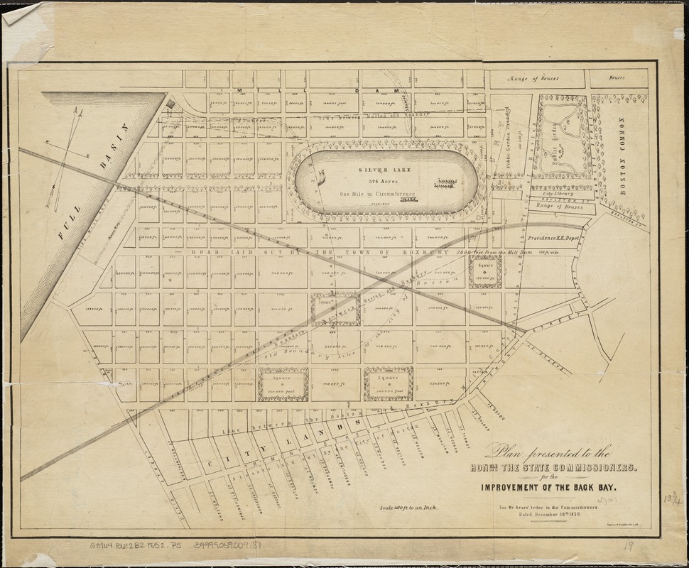
The Back Bay was once a marsh flat, but by the late 1840s, the severely polluted quagmire was considered a public health hazard, and officials had no choice but to act. The Commissioners on Boston Harbor and the Back Bay were tasked with devising a plan to fill in the flat. They met in 1852 and heard the proposals of a number of stakeholders, including David Sears; a version of his plan, shown here, features a 37 ½-acre Silver Lake, complete with a tree-lined promenade. The Commissioners ultimately rejected his proposal, and commenced the land reclamation project in 1858.
- Date:
-
[1852]
- Format:
-
Maps/Atlases
- Location:
-
Boston Public Library
Norman B. Leventhal Map Center - Collection (local):
-
Norman B. Leventhal Map Center Collection
- Subjects:
-
City planning--Massachusetts--Boston--Back Bay--Maps
Back Bay (Boston, Mass.)--Maps
Sears, David, 1787-1871
- Places:
-
Suffolk (county)BostonBack Bay
- Extent:
- 1 map ; 36 x 48 cm.
- Terms of Use:
-
No known copyright restrictions.
No known restrictions on use.
- Publisher:
-
Boston :
s.n.
- Scale:
-
Scale: 1:4,800.
- Language:
-
English
- Notes:
-
Oriented with north toward the upper right.
"See Mr. Sear's letter to the commissioners dated December 30th, 1850."
Issued with: Massachusetts Senate documents, 1852 (no. 45).
- Notes (date):
-
This date is inferred.
- Notes (exhibitions):
-
Exhibited: "Breathing Room: Mapping Boston's Green Spaces" organized by the Norman B. Leventhal Map Center at the Boston Public Library, 2018.
- Identifier:
-
06_01_005002
- Call #:
-
G3764.B6:2B2 1852 .P5
- Barcode:
-
39999059009181


