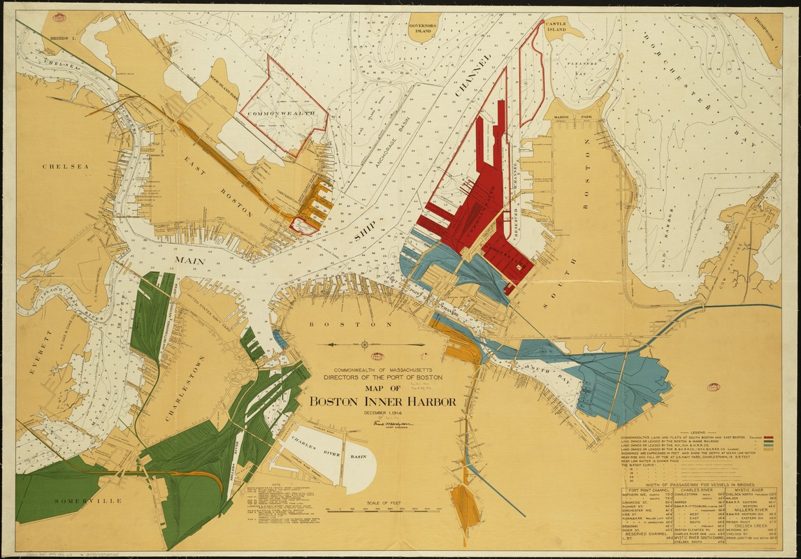
Map of Boston inner harbor
Item Information
- Title:
- Map of Boston inner harbor
- Creator:
- Massachusetts. Directors of the Port of Boston
- Date:
-
1914
- Format:
-
Maps/Atlases
- Location:
-
Boston Public Library
Norman B. Leventhal Map Center - Collection (local):
-
Norman B. Leventhal Map Center Collection
- Subjects:
-
Docks--Massachusetts--Boston--Maps
Wharves--Massachusetts--Boston--Maps
Boston Harbor (Mass.)--Maps
- Places:
-
Boston Harbor
- Extent:
- 1 map : col. ; 90 x 130 cm.
- Terms of Use:
-
No known copyright restrictions.
No known restrictions on use.
- Publisher:
-
[Boston] :
Directors of the Port of Boston
- Scale:
-
Scale ca. 1:7,210.
- Language:
-
English
- Notes:
-
Oriented with north to the left.
Depths shown by soundings.
Includes partial directory of piers and widths of bridge passageways for vessels.
- Identifier:
-
06_01_005001
- Call #:
-
G3762.B65 1914 .M3
- Barcode:
-
39999059009165


