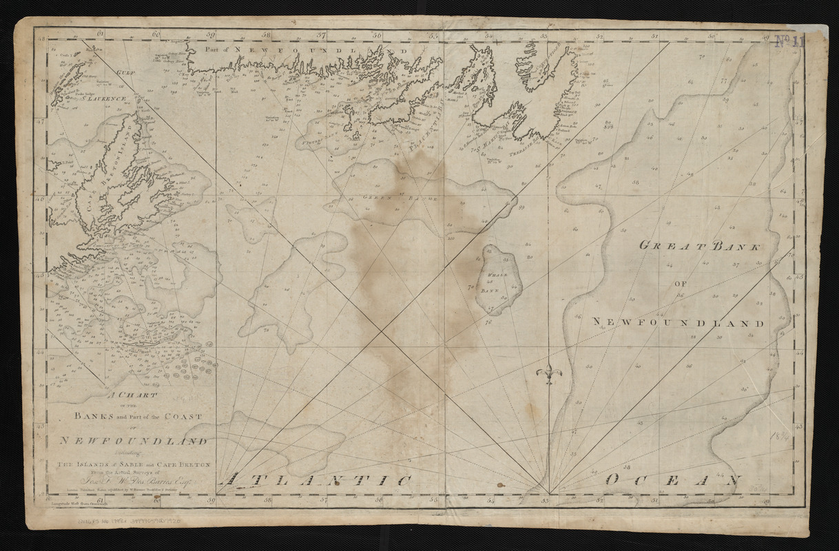
A chart of the banks and part of the coast of Newfoundland including the islands of Sable and Cape Breton
Item Information
- Title:
- A chart of the banks and part of the coast of Newfoundland including the islands of Sable and Cape Breton
- Creator:
- Des Barres, Joseph F. W. (Joseph Frederick Wallet), 1722-1824
- Cartographer:
- Des Barres, Joseph F. W. (Joseph Frederick Wallet), 1722-1824
- Publisher:
- Norman, William, -1807
- Name on Item:
-
from the actual surveys of Jos. F.W. Des Barres esqr.
- Date:
-
[1798]
- Format:
-
Maps/Atlases
- Location:
-
Boston Public Library
Norman B. Leventhal Map Center - Collection (local):
-
Norman B. Leventhal Map Center Collection
- Subjects:
-
Coasts--Newfoundland and Labrador--Maps--Early works to 1800
Nautical charts--Grand Banks of Newfoundland--Maps--Early works to 1800
Grand Banks of Newfoundland--Maps--Early works to 1800
- Places:
-
Grand Banks of Newfoundland
- Extent:
- 1 map ; 50 x 79 cm
- Terms of Use:
-
No known copyright restrictions.
No known restrictions on use.
- Publisher:
-
Boston :
W. Norman
- Scale:
-
Scale approximately 1:1,380,000
- Language:
-
English
- Notes:
-
Depths shown by soundings.
In Norman's The American pilot. Boston : William Norman, 1798.
- Notes (date):
-
This date is inferred.
- Identifier:
-
06_01_004836
- Call #:
-
G1106.P5 N6 1798x
- Barcode:
-
30000005069207


