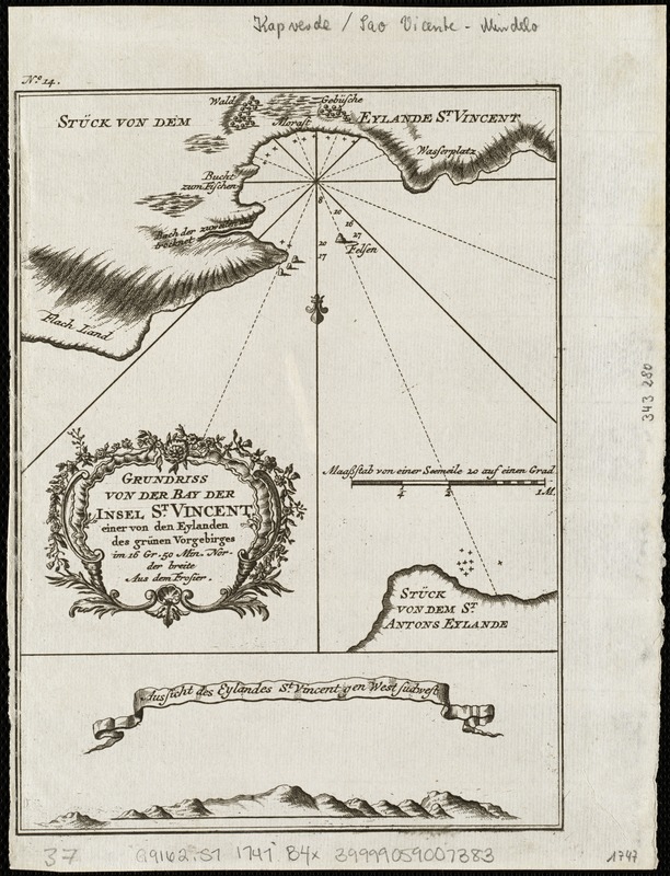
Grundriss von der bay der insel St. Vincent einer von den Eylanden des grünen Vorgebirges
Item Information
- Title:
- Grundriss von der bay der insel St. Vincent einer von den Eylanden des grünen Vorgebirges
- Creator:
- Bellin, Jacques Nicolas, 1703-1772
- Date:
-
[1747?]
- Format:
-
Maps/Atlases
- Location:
-
Boston Public Library
Norman B. Leventhal Map Center - Collection (local):
-
Norman B. Leventhal Map Center Collection
- Subjects:
-
Cape Verde--Maps--Early works to 1800
São Vicente Island (Cape Verde)--Maps--Early works to 1800
- Places:
-
Cape Verde
- Extent:
- 1 map ; 20 x 15 cm.
- Terms of Use:
-
No known copyright restrictions.
No known restrictions on use.
- Publisher:
-
Leipzig :
Merkur
- Scale:
-
Scale [ca. 1:30,170].
- Language:
-
German
- Notes:
-
Relief shown pictorially and by hachures.
Depths shown by soundings.
Oriented with noth to the bottom.
Inset: Ausschit des Eylandes St. Vincent gen West Sudwest.
In upper left margin: No. 14.
Published in the German edition by Schwabe in Leipzig of Bellin's travel books.
- Identifier:
-
06_01_004752
- Call #:
-
G9162.S7 1747 .G7x
- Barcode:
-
39999059007383


