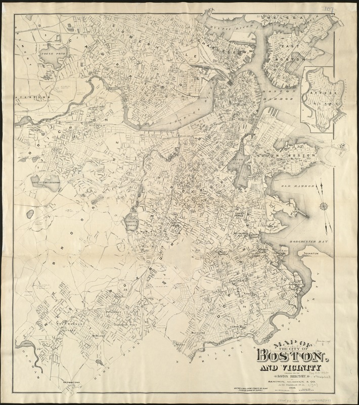
Map of the city of Boston and vicinity
Item Information
- Title:
- Map of the city of Boston and vicinity
- Creator:
- Sampson, Murdock & Co
- Date:
-
[ca. 1898]
- Format:
-
Maps/Atlases
- Location:
-
Boston Public Library
Norman B. Leventhal Map Center - Collection (local):
-
Norman B. Leventhal Map Center Collection
- Subjects:
-
Boston (Mass.)--Maps
- Places:
-
Suffolk (county)Boston
- Extent:
- 1 map ; 83 x 70 cm.
- Terms of Use:
-
No known copyright restrictions.
No known restrictions on use.
- Publisher:
-
[Boston] :
Sampson, Murdock, & Co.
- Scale:
-
Scale [1:19,200].
- Language:
-
English
- Notes:
-
Oriented with north toward the upper left.
Covers also parts of adjacent towns and cities, including all of Cambridge and Brookline.
Shows selected buildings.
"Published for the Boston directory."
"Dotted lines show streets on plans filed by Board of Survey."
Inset: [Breed's Island].
- Identifier:
-
06_01_004733
- Call #:
-
G3764.B6 1898 .S2
- Barcode:
-
39999059007177


