City of Boston plan of Columbia Road, showing connection with Franklin Park and Marine Park : under chapter 394 acts of 1897
Item Information
- Title:
- City of Boston plan of Columbia Road, showing connection with Franklin Park and Marine Park : under chapter 394 acts of 1897
- Title (alt.):
-
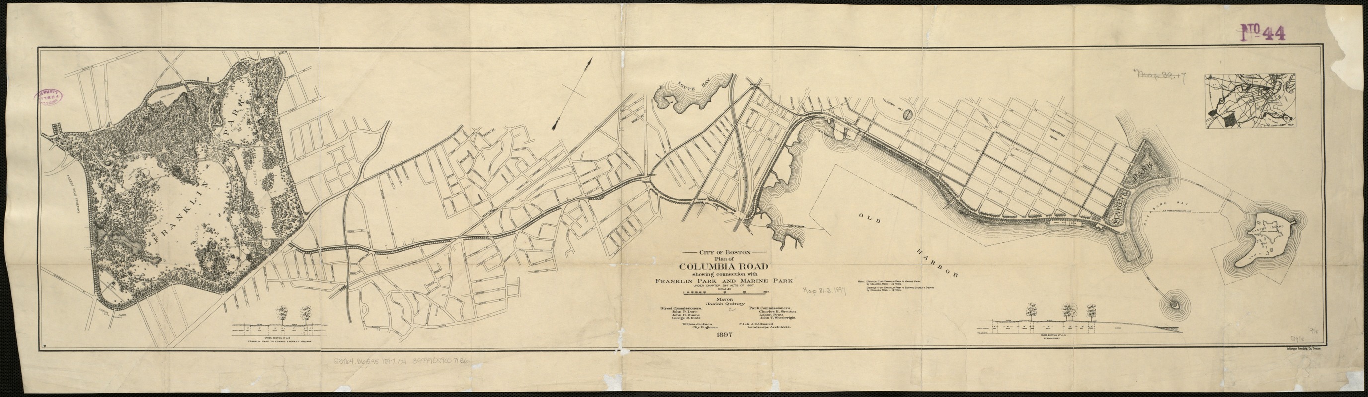
Plan of Columbia Road, showing connection with Franklin Park and Marine Park
- Description:
-
When Olmsted first conceived the Boston park system, Columbia Road was intended to be a greenway connecting Franklin Park to Marine Park, as shown in this 1897 plan. This vision was never realized, as Columbia Road was already lined with buildings and used for commercial traffic. Today, Columbia Road is a busy thoroughfare bisected by a sparsely planted median. As part of its 2030 vision for a healthier, better connected city, the City of Boston plans to develop the Columbia Road Greenway, a green corridor with improved pedestrian and bike paths. The proposed greenway will link Franklin and Moakley Parks, finally completing the Emerald Necklace.
- Creator:
- Olmsted, Frederick Law, 1822-1903
- Name on Item:
-
Street Commissioners, Park Commissioners ; William Jackson, city engineer ; F.L. & J.C. Olmsted, landscape architects.
- Date:
-
1897
- Format:
-
Maps/Atlases
- Location:
-
Boston Public Library
Norman B. Leventhal Map Center - Collection (local):
-
Norman B. Leventhal Map Center Collection
- Subjects:
-
Streets--Massachusetts--Boston--Maps
Parks--Massachusetts--Boston--Maps
Boston (Mass.)--Maps
- Places:
-
Suffolk (county)Boston
- Extent:
- 1 map ; 23 x 100 cm.
- Terms of Use:
-
No known copyright restrictions.
No known restrictions on use.
- Publisher:
-
Boston :
Heliotype Print. Co.
- Scale:
-
Scale [ca. 1:9,600].
- Language:
-
English
- Notes:
-
Oriented with north toward the upper right.
Shows streets and U.S. Harbor Commissioners' line.
Relief shown by spot heights.
Includes distance note and cross sections: Franklin Park to Edward Everett Square ; Strandway.
Inset: Key map.
- Notes (exhibitions):
-
Exhibited: "Breathing Room: Mapping Boston's Green Spaces" organized by the Norman B. Leventhal Map Center at the Boston Public Library, 2018.
- Identifier:
-
06_01_004729
- Call #:
-
G3764.B6G45 1897 .O4
- Barcode:
-
39999059007136


