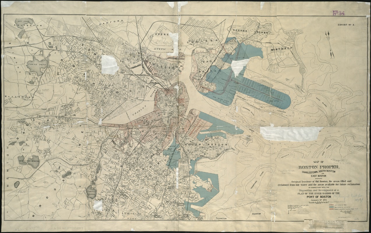
Map of Boston proper, Charlestown, South Boston and East Boston : showing original territory of old Boston, the areas filled and reclaimed from tide water and the areas available for future reclamation ... port of Boston
Item Information
- Title:
- Map of Boston proper, Charlestown, South Boston and East Boston : showing original territory of old Boston, the areas filled and reclaimed from tide water and the areas available for future reclamation ... port of Boston
- Creator:
- Boston (Mass.). City surveyor
- Date:
-
1894
- Format:
-
Maps/Atlases
- Location:
-
Boston Public Library
Norman B. Leventhal Map Center - Collection (local):
-
Norman B. Leventhal Map Center Collection
- Subjects:
-
Cities and towns--Growth--Massachusetts--Boston--Maps
Boston (Mass.)--Maps
Boston Harbor (Mass.)--Maps
- Places:
-
Boston Harbor
- Extent:
- 1 map : col. ; 58 x 103 cm.
- Terms of Use:
-
No known copyright restrictions.
No known restrictions on use.
- Publisher:
-
Boston :
[s.n.]
- Scale:
-
Scale 1:19,764.
- Language:
-
English
- Notes:
-
Oriented with north toward the upper left.
Depths shown by soundings.
- Identifier:
-
06_01_004706
- Call #:
-
G3764.B6 1894 .B67
- Barcode:
-
39999059007029


