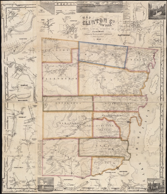
Map of Clinton Co., New York : from actual surveys
Item Information
- Title:
- Map of Clinton Co., New York : from actual surveys
- Creator:
- Ligowsky, A.
- Name on Item:
-
by A. Ligowsky.
- Date:
-
1856
- Format:
-
Maps/Atlases
- Location:
-
Boston Public Library
Norman B. Leventhal Map Center - Collection (local):
-
Norman B. Leventhal Map Center Collection
- Subjects:
-
Clinton County (N.Y.)--Maps
- Places:
-
Clinton (county)
- Extent:
- 1 map : col. ; 136 x 118 cm.
- Terms of Use:
-
No known copyright restrictions.
No known restrictions on use.
- Publisher:
-
Philadelphia :
O.J. Lamb
- Scale:
-
Scale not given.
- Language:
-
English
- Notes:
-
Relief shown by hachures.
Includes insets of towns, tables of distances, statistics of the county, and four illustrations.
- Identifier:
-
06_01_004400
- Call #:
-
G3803.C7 1856 .L5
- Barcode:
-
39999059006492


