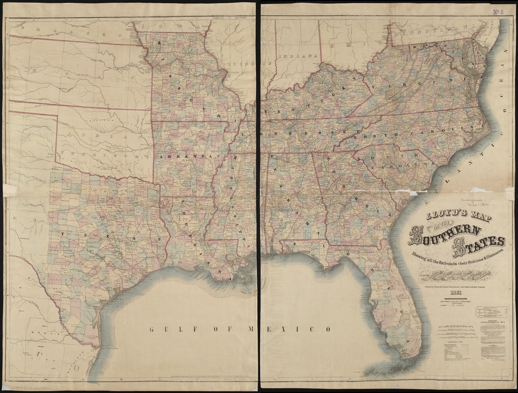
Lloyd's map of the Southern States, showing all the railroads, their stations & distances : also the counties, towns, villages, harbors, rivers, and forts
Item Information
- Title:
- Lloyd's map of the Southern States, showing all the railroads, their stations & distances : also the counties, towns, villages, harbors, rivers, and forts
- Creator:
- Lloyd, James T.
- Date:
-
1861
- Format:
-
Maps/Atlases
- Location:
-
Boston Public Library
Norman B. Leventhal Map Center - Collection (local):
-
Norman B. Leventhal Map Center Collection
- Subjects:
-
Railroads--Southern States--Maps
Southern States--Maps
- Places:
-
Southern United States (area)
- Extent:
- 1 map on 2 sheets : col. ; 93 x 129 cm.
- Terms of Use:
-
No known copyright restrictions.
No known restrictions on use.
- Publisher:
-
New York :
J.T. Lloyd
- Scale:
-
Scale [ca. 1:2,000,000]
- Language:
-
English
- Notes:
-
Relief shown by hachures. Depths shown by form lines.
"Entered according to act of Congress in the year 1861 by J.T. Lloyd in the Clerk's Office of the District Court of the United States ..."
Text of newspaper, entitled "Lloyd's military map and gazetteer of the Southern States, Saturday, September 7, 1861" on verso.
- Identifier:
-
06_01_004398
- Call #:
-
G3861.P3 1861 .L4
- Barcode:
-
39999059006484
- LCCN:
-
91684704


