Map of the town of Dartmouth, Bristol County Mass
Item Information
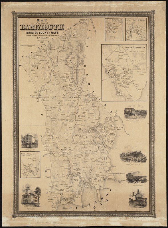
- Title:
- Map of the town of Dartmouth, Bristol County Mass
- Creator:
- Walling, Henry Francis, 1825-1888
- Name on Item:
-
made by order of the town under the direction of H.F. Walling.
- Date:
-
1856
- Format:
-
Maps/Atlases
- Location:
-
Boston Public Library
Norman B. Leventhal Map Center - Collection (local):
-
Norman B. Leventhal Map Center Collection
- Subjects:
-
Landowners--Massachusetts--Dartmouth--Maps
Dartmouth (Mass.)--Maps
- Places:
-
Bristol (county)Dartmouth
- Extent:
- 1 map ; 85 x 57 cm.
- Terms of Use:
-
No known copyright restrictions.
No known restrictions on use.
- Publisher:
-
S.l :
[s.n.]
- Scale:
-
Scale 1:25,000.
- Language:
-
English
- Notes:
-
Shows buildings with names of property owners and town districts.
Relief shown by hachures.
Insets: Hicksville [ca. 1:7,920] -- Smith Mills [ca. 1:7,920] -- South Dartmouth [1:7,920] -- Russell Mills [1:7,920].
Includes 6 vignettes of town buildings and structures.
- Identifier:
-
06_01_004171
- Call #:
-
G3764.D32 1856 .W3
- Barcode:
-
39999059004661


