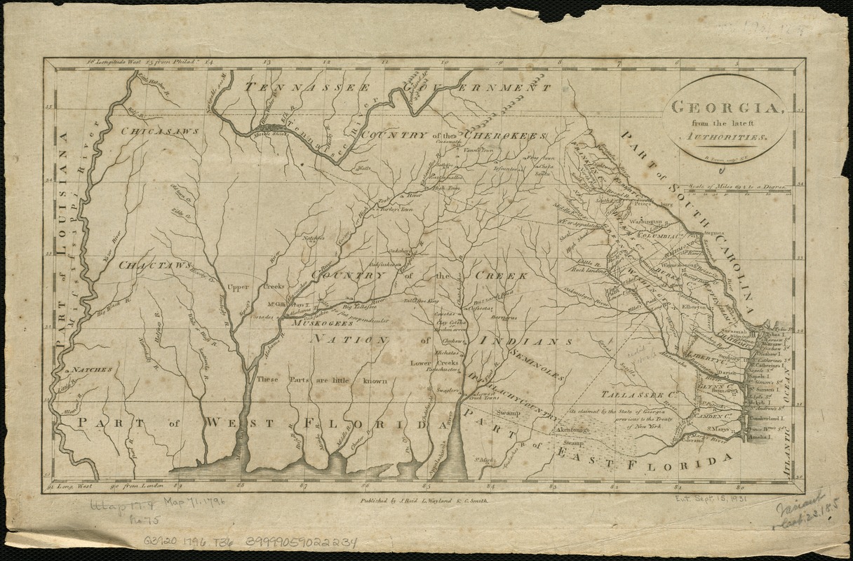
Georgia, from the latest authorities
This map is also available in American Revolutionary Geographies Online (ARGO), a collections portal especially built for material relating to the American Revolutionary War Era. Visit ARGO to learn more about this item and explore the historical geography of North America in the late eighteenth century.
Item Information
- Title:
- Georgia, from the latest authorities
- Creator:
- Tanner, Benjamin, 1775-1848
- Name on Item:
-
B. Tanner, sculpt.
- Date:
-
[1796]
- Format:
-
Maps/Atlases
- Location:
-
Boston Public Library
Norman B. Leventhal Map Center - Collection (local):
-
Norman B. Leventhal Map Center Collection
- Subjects:
-
Southern States--Maps--Early works to 1800
Georgia--Maps--Early works to 1800
- Places:
-
Georgia
Southern United States (area)
- Extent:
- 1 map ; 21 x 38 cm.
- Terms of Use:
-
No known copyright restrictions.
No known restrictions on use.
- Publisher:
-
[New York] :
J. Reid, L. Wayland, and C. Smith
- Scale:
-
Scale [ca. 1:3,000,000].
- Language:
-
English
- Notes:
-
Relief shown pictorially.
Indicates Indian tribes.
Includes area west to Mississippi River.
- Notes (date):
-
This date is inferred.
- Identifier:
-
06_01_004082
- Call #:
-
G3920 1796 .T36
- Barcode:
-
39999059022234


