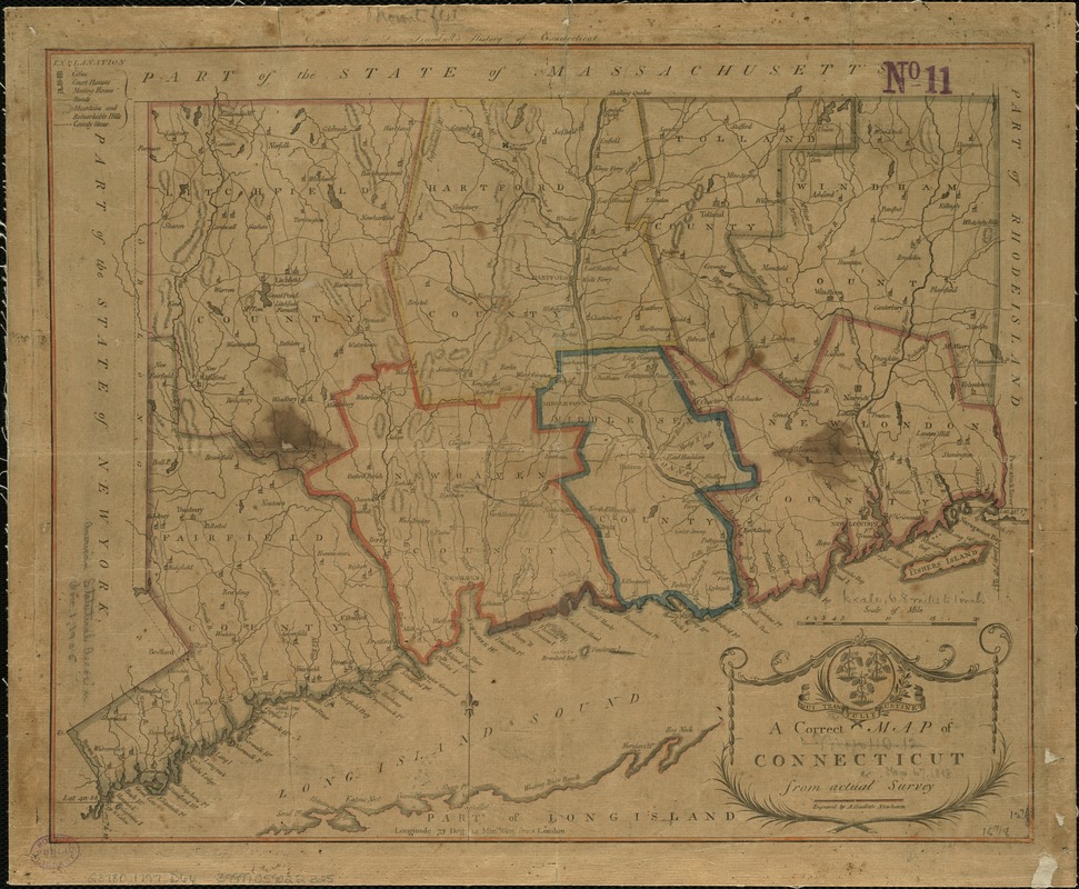
A correct map of Connecticut from actual survey
This map is also available in American Revolutionary Geographies Online (ARGO), a collections portal especially built for material relating to the American Revolutionary War Era. Visit ARGO to learn more about this item and explore the historical geography of North America in the late eighteenth century.
Item Information
- Title:
- A correct map of Connecticut from actual survey
- Creator:
- Doolittle, Amos, 1754-1832
- Name on Item:
-
engraved by A. Doolittle.
- Date:
-
1797
- Format:
-
Maps/Atlases
- Location:
-
Boston Public Library
Norman B. Leventhal Map Center - Collection (local):
-
Norman B. Leventhal Map Center Collection
- Subjects:
-
Connecticut--Maps--Early works to 1800
- Places:
-
Connecticut
- Extent:
- 1 map ; 33 x 41 cm.
- Terms of Use:
-
No known copyright restrictions.
No known restrictions on use.
- Publisher:
-
New Haven :
[s.n.]
- Scale:
-
Scale 1:422,400
- Language:
-
English
- Notes:
-
Relief shown by hachures.
Includes "Explanation" for cities, court houses, meeting houses, roads, mountains, and county lines.
Prime meridian: London.
"Engraved for Dr. Trumbull's History of Connecticut."
- Identifier:
-
06_01_004073
- Call #:
-
G3780 1797 .D66
- Barcode:
-
39999059022325


