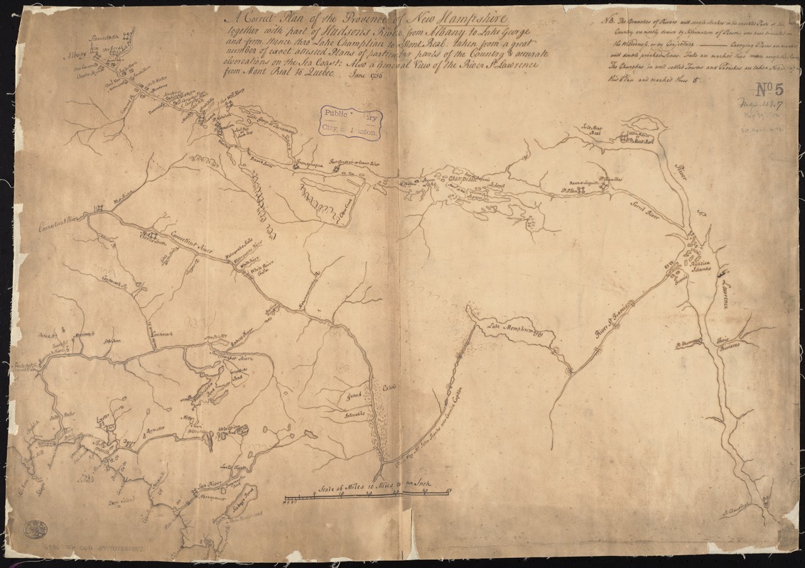
A correct plan of the province of New Hampshire together with part of the Hudsons River from Albany to Lake George and from thence thro Lake Champlain to Mont Real : taken from a great number of exact attested plans of particular parts of the country & accurate observations on the sea coast : also a general view of the River St. Lawrence from Mont Real to Quebec
Item Information
- Title:
- A correct plan of the province of New Hampshire together with part of the Hudsons River from Albany to Lake George and from thence thro Lake Champlain to Mont Real : taken from a great number of exact attested plans of particular parts of the country & accurate observations on the sea coast : also a general view of the River St. Lawrence from Mont Real to Quebec
- Date:
-
[1880?]
- Format:
-
Maps/Atlases
Manuscripts
- Location:
-
Boston Public Library
Norman B. Leventhal Map Center - Collection (local):
-
Norman B. Leventhal Map Center Collection
- Subjects:
-
New Hampshire--Maps, Manuscript
Northeastern States--Maps, Manuscript
- Places:
-
Northeastern United States (area)
New Hampshire
- Extent:
- 1 ms. map ; on sheet 50 x 72 cm.
- Terms of Use:
-
No known copyright restrictions.
No known restrictions on use.
- Scale:
-
Scale 1:633,600.
- Language:
-
English
- Notes:
-
Manuscript map. Copy of original from 1756.
Relief shown pictorially.
Oriented with north toward the right.
- Identifier:
-
06_01_004067
- Call #:
-
G3710 1756 .C67x
- Barcode:
-
39999059022382


