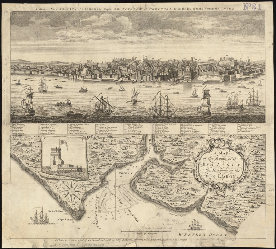
A map of the mouth of the River Tagus or the Harbour of the city of Lisbon
Item Information
- Title:
- A map of the mouth of the River Tagus or the Harbour of the city of Lisbon
- Title (alt.):
-
A view of the city of Lisbon (the capital of the Kingdom of Portugal) before the late dreadful earthquake Nov. 1, 1755
- Date:
-
[1755–1759]
- Format:
-
Maps/Atlases
- Location:
-
Boston Public Library
Norman B. Leventhal Map Center - Collection (local):
-
Norman B. Leventhal Map Center Collection
- Subjects:
-
Lisbon (Portugal)--Maps
Lisbon (Portugal)--Aerial views
Tagus River (Spain and Portugal)--Maps
- Places:
-
Tagus (river)
PortugalLisbon (territory)Lisbon
- Extent:
- 2 maps on 1 sheet ; on sheet 47 x 52 cm.
- Terms of Use:
-
No known copyright restrictions.
No known restrictions on use.
- Publisher:
-
London :
sold by Eliz. Bakewell and I. Brotherton
- Scale:
-
Scale [ca. 1:202,752].
- Language:
-
English
- Notes:
-
Oriented with north toward the upper left.
Relief shown pictorially.
Depths shown by soundings.
Includes ancillary map: A view of the city of Lisbon (the capital of the Kingdom of Portugal) before the late dreadful earthquake Nov. 1, 1755.
Includes index to points of interest.
Includes inset of the Castle of Belem.
Cataloging, conservation, and digitization made possible in part by The National Endowment for the Humanities: Exploring the human endeavor.
- Notes (date):
-
This date is inferred.
- Identifier:
-
06_01_003983
- Call #:
-
G6694.L5 1755 .M3x
- Barcode:
-
39999059003341


