Preliminary plan for Wood Island Park, East Boston
Item Information
- Title:
- Preliminary plan for Wood Island Park, East Boston
- Description:
-
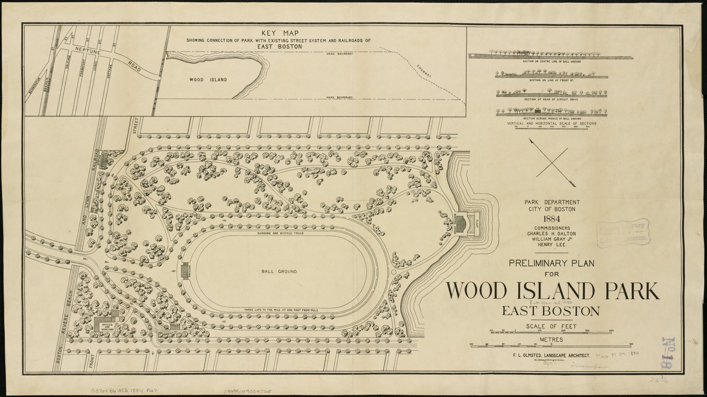
Frederick Law Olmsted’s celebrated Emerald Necklace often eclipses his five smaller, isolated parks in Boston, like Wood Island Park in East Boston. Though this plan shows a simple park featuring few walks and a playing field, Olmsted would transform Wood Island into his largest neighborhood park, with forty-six acres of public beach, picnic areas, tennis courts, outdoor gymnasiums for men and women, playgrounds, and several promenades. Despite its popularity, the park was razed for the expansion of Logan Airport in the mid-20th century, setting off decades of community activism and park advocacy.
- Creator:
- Boston (Mass.). Park Commissioners
- Date:
-
[1884]
- Format:
-
Maps/Atlases
- Location:
-
Boston Public Library
Norman B. Leventhal Map Center - Collection (local):
-
Norman B. Leventhal Map Center Collection
- Subjects:
-
Parks--Massachusetts--Boston
East Boston (Boston, Mass.)--Maps
- Places:
-
Suffolk (county)BostonEast Boston
- Extent:
- 1 plan ; 36 x 68 cm.
- Terms of Use:
-
No known copyright restrictions.
No known restrictions on use.
- Publisher:
-
Boston, Mass :
s.n.
- Scale:
-
Scale 1:1,200.
- Language:
-
English
- Notes:
-
Oriented with north toward the upper left.
Inset: Key map showing connection of park with existing street system and railroads of East Boston.
Includes four sections of the grounds.
"F.L. Olmsted, landscape architect."
- Notes (date):
-
This date is inferred.
- Notes (exhibitions):
-
Exhibited: "Breathing Room: Mapping Boston's Green Spaces" organized by the Norman B. Leventhal Map Center at the Boston Public Library, 2018.
- Identifier:
-
06_01_003890
- Call #:
-
G3764.B6:2E2 1884 .B67
- Barcode:
-
39999059002566


