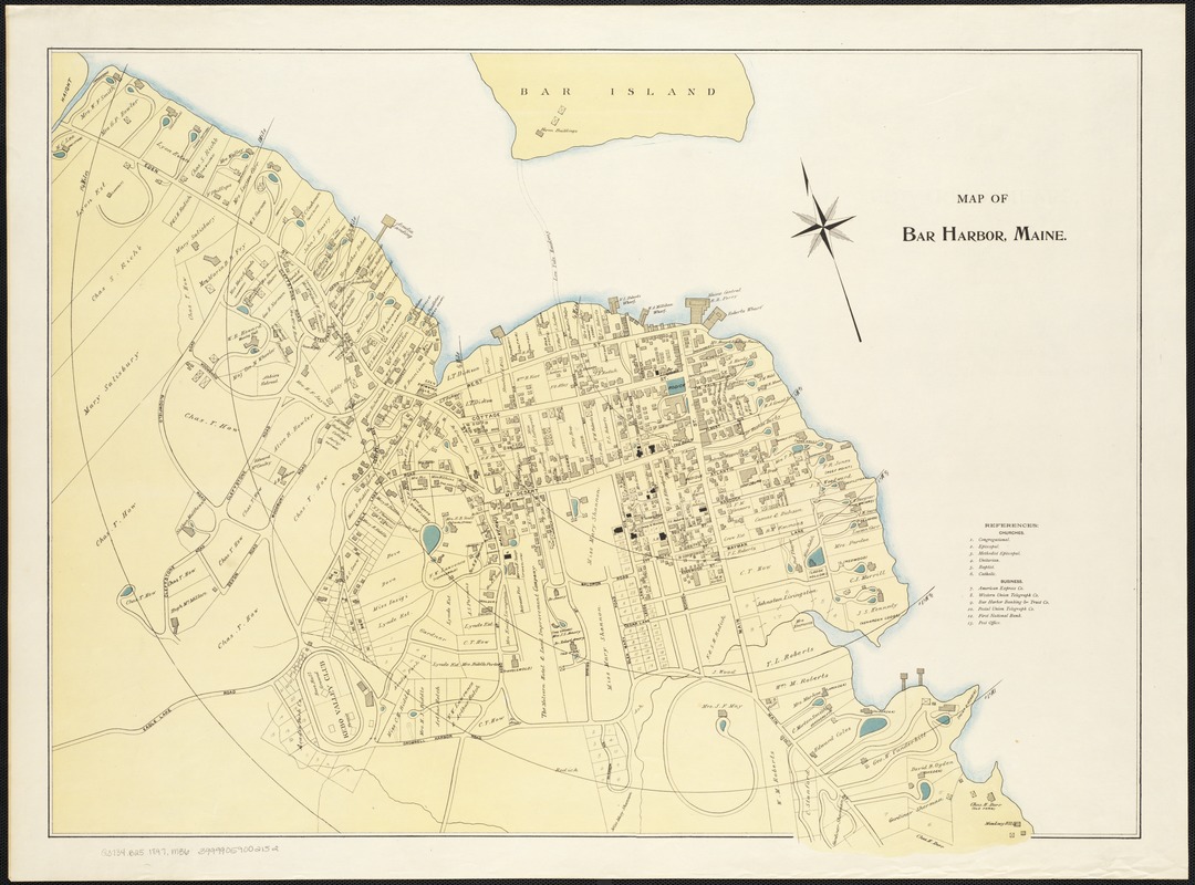
Map of Bar Harbor, Maine
Item Information
- Title:
- Map of Bar Harbor, Maine
- Date:
-
[1897?]
- Format:
-
Maps/Atlases
- Location:
-
Boston Public Library
Norman B. Leventhal Map Center - Collection (local):
-
Norman B. Leventhal Map Center Collection
- Subjects:
-
Real property--Maine--Bar Harbor--Maps
Land tenure--Maine--Bar Harbor--Maps
Bar Harbor (Me.)--Maps
- Places:
-
Hancock (county)Mount Desert Island (island)Bar Harbor
- Extent:
- 1 map : col. ; 54 x 73 cm.
- Terms of Use:
-
No known copyright restrictions.
No known restrictions on use.
- Publisher:
-
S.l :
s.n.
- Scale:
-
Scale not given.
- Language:
-
English
- Notes:
-
Oriented with north toward the upper left.
Part cadastral map showing property boundaries, buildings, names of property owners and radial distances from waterfront.
- Identifier:
-
06_01_003795
- Call #:
-
G3734.B25 1897 .M36
- Barcode:
-
39999059002152


